One of the gentler walks my wife and I take from Como is one which takes us along the lakeside all the way to Cernobbio. We choose it when one (or both) of us are feeling tired or have a pain somewhere in our ageing bodies or when it’s really too cold to venture higher up on the hills around the lake.
We start at the train station of Como Lago (which is a charming rinky-dink little station with an entrance in Liberty style, much nicer than the rather grim main station at Como).
We pass the soccer stadium which is home to the town’s home team, Como 1907 (which looks quite nice in this aerial view, although all we see are the forbidding outer walls).
I nod at a statue of our old friend St. John Nepomuk, standing rather forlornly on the lake’s edge.
My photo
The road brings us to the old village of Tavernola (now a drab suburb of Como), where we branch off along a long straight road that passes the Liberty-style villa Bernasconi, once the property of a rich manufacturer of silk and now a museum.
The last time I was there, I had a magnificent osso buco with risotto.
My wife’s photo
One of the pleasures of the section of the walk along the busy main road (apart from getting to nod hello to a mouldering statue of St. John Nepomuk down by the water’s edge) is watching the seaplanes from Aero Club Como taking off and landing.
I’m very fond of these seaplanes. There’s something quite beautiful about these little planes skimming across the water, their engines at full throttle, finally rising off the water surface and soaring up, up, up
and then banking to fly along the lake, the drone of their engines bouncing off the hills (I love the noise of prop engines, so much nicer than the ear-splitting whine of jet engines).
During the years between World Wars I and II, the use of seaplanes flourished: the “airfields” were free, compared to the high cost of building airfields on land. Various commercial lines were established, giving rise to some wonderful poster art.
Things changed dramatically after the Second World War. Many of the military airfields which had been built during the war were no longer needed and could be turned over to civilian use. Suddenly, land-based airfields were available cheap, and so the main competitive advantage of seaplanes disappeared. On top of that, land-based planes were much less affected by weather (even small waves could halt seaplane flights) and they flew faster (the aerodynamics of seaplanes are poorer). The result was a swift decline in the use of seaplanes, which are now squeezed into a few niche uses, like aerial firefighting, access to undeveloped or roadless areas which have numerous lakes, air transport around archipelagos …
… as well, of course, as the offering of scenic flights over dramatic lakes.
In the late 1940s, 1947 I’m guessing, My parents took what was probably one of the last long-distance seaplane flights offered by BOAC, which ran between Sydney and Southampton. They boarded at Karachi and stopped off at Bahrain, Cairo, Augusta in Sicily, and Marseilles, before arriving in Southampton.
Once, in a moment of madness, as we watched a seaplane gracefully lift off Lake Como, I excitedly suggested to my wife that we take one of the scenic flights offered by the Aereo Club. A check of the prices soon put paid to that idea. Ah well, another experience of my parents which I will never share.
My wife and I recently completed a four-day hike around the Danube, in the reaches of the river some 20 km upstream from Linz. We started in the village of Ottensheim, made our way to Eferding and then to Aschach, ending the hike in the village of Sankt Martin. I can’t resist inserting here a composite photo I’ve created of the hike.
My composite
As readers can see, we wandered rather drunkenly along the Danube.
The wonderful thing about hiking is that you move slowly across the landscape, which allows you to notice things which you probably wouldn’t notice on a bike, let alone a car. I give my readers here a taste of what my wife and I came across – quite serendipitously – as we slowly crossed this Danubian landscape.
Thursday
We arrive in Ottensheim, which sits on the Danube river, in the early afternoon. We take advantage of our early arrival to go for a walk on the high lands behind the town. Here is the view of the Danube which greets us at the top. You can see the hydroelectric dam spanning the river. We’ll be passing that dam tomorrow.
My photo
We have pizza at the place we’re staying the night, down by the river’s bank. We chat with the staff, all Neapolitans, who all left Naples because of a lack of opportunities there. A story we’ve heard so many times. Such a tragedy for Naples, this steady draining away of their youth.
Friday
We’re greeted at the exit of the hotel by this strange painting on the wall of a house.
My photo
Not sure what happened to the mermaid’s nose …
We’re waiting to board the ferry, which will carry us over to the other bank.
My photo
While waiting, we spy a statue of St. Johann Nepomuk, protector of those who cross streams and rivers, so common in this part of the world. This statue is coloured, though, which is rare.
My photo
The view from the ferry’s deck, looking upstream. The hydroelectric dam is in the far distance.
My photo
We can also see a peek of Ottensheim’s local castle in that last photo. We get a better view as we start walking along the river’s bank.
My photo
Its recent history has been quite eventful. Owned by a British family in the 1930s, it was confiscated by the Nazis at the beginning of the war. They used it as a forestry office for the Wermacht. After the war, the Soviets, who occupied that side of the Danube, used it as a barracks. After they left in 1955, when Austria got back its independence, the castle reverted to its pre-war owners. By then it was in a pretty sad state, but its owners didn’t have the money to restore it. It was only in 1988, when the castle was sold to a group of families with deeper pockets, that the castle could be restored. It is still in private hands.
Yellow irises blooming along the water’s edge, the first of many wildflowers we will be seeing on this hike.
My photo
Close by, a memorial on the side of the path.
My photo
It commemorates the nearly 30,000 people murdered through poisoning with carbon monoxide by the Nazi regime in nearby Hartheim castle, between May 1940 and December 1944. Once their bodies had been cremated the ashes were brought to this spot and dumped into the Danube. Until September 1941, it was a “euthanasia” centre, where 8,000 physically and mentally handicapped people, almost all from Bavaria and Austria, were murdered. After Hitler closed down the Nazis’ euthanasia programme (because of protests from the Roman Catholic Church in Germany), the centre quickly “pivoted” to become a centre for the killing of inmates from nearby concentrations camps, primarily Mauthausen or its satellite camps, who were too sick or injured to work any longer. By December 1944, they had murdered a further 12,000 people, most of them Soviet Prisoners of War.
Wildflowers by the side of the path
My photo
Outside a fire station, an intriguing monument to firemen and women, as well as to officers of the Austrian river authority.
My photo
An old farmhouse on the edge of the road.
My photo
Eferding, the end point of today’s hike, with the parish church’s bell tower dominating the town.
My photo
A photo of Eferding’s castle, taken by slipping my iPhone through the big gates that barred entry.
My photo
The castle is still owned by the Starhemberg family, who inherited it and the lands that came with it in 1559. Interesting family. They’ve been involved in Austrian politics for the last 1,000 years or so. The latest (in)famous member of the family was Ernst Rüdiger Prince von Stahremberg, who was born in 1899 in the castle and died in 1956 in Voralberg. He was a right-wing politician with great admiration for Mussolini’s fascism. He served in Austria’s right-wing governments from 1930 until 1936. Although fascistic, he really disliked the Nazis and made his dislike very public, so after the Anschluss of 1938 he fled to Switzerland to avoid vengeful retaliation by the Nazis (and perhaps also to protect his wife, who was Jewish). At the beginning of World War II, he served in some capacity in the British and Free French Air Forces, but he resigned in disgust after the UK and the US allied themselves with the Soviet Union in 1941 – he viewed communism and Nazism as equally evil. Thereafter, he and his wife left for Argentina; not unnaturally, he felt a great affinity with the politics of Juan Peron. In 1956, after Peron had been ousted by the army, he travelled to Austria for an extended visit, no doubt to explore the possibility of coming back. He was staying at a spa in Schruns (the bell tower of whose parish church I had so admired last year). During a walk, he was photographed by a journalist who worked at a communist newspaper. In a rage, he attacked the journalist with his walking stick, but this triggered a cardiac arrest and he died there on the pavement.
Turning my back on the Stahremberg castle, a view of Eferding’s main square
We begin to climb a steep ridge. We pass a shrine on the side of the road.
My photo
Shrines are common throughout Austria, but I notice that in this region shrines – like this one – have an eye painted on them. I suppose it represents God, the “All-Seeing Eye”. But I find it rather unnerving: “You can’t hide from me, I can see everything that you do” – just like Big Brother in George Orwell’s “Nineteen Eighty-Four”.
A chapel at the top of the ridge.
My photo
A spray of daisies on the side of the road.
My photo
We plunge into the woods.
My photoMy photo
A view over the plain around Eferding.
My photo
We come down the ridge and pass the small airfield – literally, in this case – of a gliding club.
My photo
We have been watching the gliders soaring over us all morning; my iPhone, alas, cannot capture their ethereal beauty.
We look back at the ridge we walked along, with a castle ruin sitting on it.
My photo
We stop for lunch in the village of Pupping, finding a bench in the parish church’s garden to sit on. I, of course, cannot pass up the opportunity of visiting the church after lunch. I find a mix of old and new.
A statue of St. Wolfgang, who, it is said, died at the altar of the (original) church in 994 CE.
My photo
A statue of St. Christopher, looking less than pleased with having to carry the Child Jesus.
My photo
Four carved door lintels, displaying the symbols of the four Evangelists: clockwise from the top left, the lion of St. Mark (you have to look hard to see the lion’s face), the ox of St. Luke, the angel of St. Matthew, and the eagle of St. John.
My photos
It takes me a while to understand that Luke’s angel is represented by an eye – the eye again …
Rather pleasant stained-glass windows.
My photo
We continue the hike towards our end point today, Aschach, on the Danube. Quite by chance, our route takes us past a war cemetery.
But actually, although the cemetery is looked after by the German association for war graves (hence the look), none of the soldiers buried there are Austrian or German. And none of the dead who are commemorated fell on the frontline; they were all prisoners of war who died in a POW camp which the Austro-Hungarians built close by for use during the First World War. They were mainly Italians
My photo
with their memorial
My photo
and Serbians
My photo
with theirs.
My photo
After the Second World War, the Soviets put up a memorial to their POWs who had been murdered in Mauthausen and other nearby concentration camps.
My photo
Of course, the thousands of murdered Soviet POWs didn’t get an individual grave, their names were not even inscribed on a monument. But some Russian family had come and attached a photo of one Soviet prisoner to a stone cross, with the epitaph “We remember, we love, we grieve. The grandchildren”.
My photo
We walk on to Aschach.
Sunday
We start the day by once again crossing the Danube, but this time using a bridge rather than on a ferry.
My photo
Some purple irises catch my eye as we walked along the river bank.
My photo
We climb up to the high lands overlooking the river, past fields of wheat studded with corn flowers and daisies.
My photo
We enter the woods.
My photo
The path eventually leads us off the high lands and down to a stream at the bottom of a valley. We start following the stream towards its source. At first, the stream cheerfully burbles along.
My wife’s photo
But soon the stream bed becomes rough as stones from above have tumbled down, and the water jumps around.
My photoMy photo
The path mimics the roughness of the stream.
My wife’s photo
Once we reach the high lands, the stream quietens down, the path likewise.
My photo
We pass meadows along the stream’s banks. Some have been turned into lawns.
My photo
Here, another anonymous sculptor has turned a tree trunk into a whimsical totem pole.
My photo
One of the meadows is carpeted in pink flowers.
My photo
Finally, we leave the stream and climb up onto a ridge. An alpine pasture falls away to our right. It is impossibly green.
My photo
We pass through Sankt Martin and start walking along a main road. This is the only way to our hotel. We pass a building site, where a riot of poppies grow: beauty clothing the ugliness.
As in the case of my previous post, the little trip my wife and I recently undertook in central Italy was kicked off by an article in the Guardian which I read some four-five months ago now (although quite how I got to it I can no longer remember; the article is more than three years’ old). The article was about a fresco by the Renaissance artist Piero della Francesca depicting Mary pregnant with Jesus.
It was such a different depiction of Mary when pregnant. The only paintings I know of where we see her pregnant are depictions of the Visitation, the story in the New Testament where Mary goes to meet Elizabeth and both women are pregnant. Here is a nice example of the genre, by Rogier Van der Weyden, where it is clear that both women are pregnant; in many versions of the Visitation, you would be hard put to see that the two are “with child”, as they used to say.
But Piero della Francesca has Mary alone, not doing anything in particular, just resting her hand on her belly. Such a natural pose! I remember vividly my wife doing exactly the same when she was pregnant with our two children.
Charmed by this fresco, I immediately proposed to my wife that we go to see it. She said she was all for it as long as we got some hiking in too. The fresco is held in a village called Monterchi, on the borders of Tuscany. Once I discovered that we would need to get to Monterchi via Arezzo, I proposed that we also visit Arezzo – I had visited the town fifty years ago, my wife never. And then I saw that one of the earlier stages of the Via di Francesco, the Way of Francis, several stages of which we hiked back in October 2023, passed through Citerna, a village across from Monterchi. So then we decided to walk from Citerna to Sansepolcro. Then late in the planning, we discovered that there was going to be a “once in a lifetime” exhibition of Caravaggio, my favourite painter, in Rome. My wife eventually persuaded me that we should tack on a quick visit to Rome, which allowed for an extra day’s hike to Città di Castello, followed by a two-day stay in Perugia (again, visited by me fifty years ago and by my wife never), with a final quick visit to Rome just for the exhibition.
What follows are notes on our little expedition.
Arezzo (population: 99,000)
After taking a Flixbus down to Florence, we rolled in to Arezzo train station in the early afternoon.
I have to confess that I have no idea why I decided to go to Arezzo fifty years ago. I have but one memory of the place: going to a cafe for lunch and being served by a man with a fascinating face, the type of face I see in Caravaggio’s paintings; the lunch was good, too, as I recall. But I remember nothing of what I visited. A bit embarrassing, really.
What we found was a very pleasant old town, built up a slope towards the cathedral.
I very nearly missed the town’s artistic highlight, the frescoes in the cappella maggiore in the Church of Saint Francis, by Piero della Francesca (him again; not surprising, really, he was from this part of Tuscany). On the day we set aside to visit Arezzo, the chapel was closed. No problem, we said, we’ll see it tomorrow morning before our bus leaves for Monterchi. Next morning, we were at the church when it opened, but disaster! we were informed that you had to book your visit online, and there were no spaces left. My wife, excellent negotiator that she is, managed to persuade the ladies at the ticket desk to at least allow me in. So I went in and relayed photos to my wife outside via WhatsApp. These photos, scraped from the web, are frankly much better than the ones I took.
We climbed up and over to the other side of the hill, to the old village school, which had been turned into a little museum just for Piero della Francesca’s fresco of the pregnant Madonna. I won’t repeat the photo I inserted earlier. I throw in instead a photo of a reconstruction of what the fresco originally looked like, with Mary in a tent of some sort.
My photo
It is indeed a lovely representation of pregnancy. I can understand why pregnant women in past centuries would flock to the chapel which contained it, to pray for a safe and easy birth.
Citerna (pop: 3,400)
After the visit to the museum, my wife and I walked to Citerna, sitting on the top of a high hill on the other side of the valley from Monterchi.
My wife’s photo
It was a short hike, some 2 km, but steep: the route suggested by Google Maps took us pretty much straight up the hill. What we found at the top was a sleepy little village most of whose residents were old – the fate of so many of Italy’s villages. Internet had informed me that the local church contained a statue by Donatello, although I was warned it was difficult to visit. And so it proved. The church was locked, but there was a note on the door with a phone number to call to arrange a visit. My wife called, but the man who responded told her he was in Ravenna; tomorrow morning, he said, he would be there at 9.45 – or maybe later, he wasn’t sure. Since we were planning to be on the road by 9.00, that was that. The only other thing of note in the village was splendid views of the valley which we would be hiking across the next day.
There was also a stone tablet set in a wall which got me all excited.
My photo
It commemorates the fact that Garibaldi and his beloved wife Anita stayed here in July 1849. Theirs was an impossibly romantic story. They met in 1839 in Brazil; Garibaldi was fighting in a number of wars of independence in Latin America. The way my history teacher told the story in my O-level history class (the only thing I really remember of the part of the curriculum on Italian unification), Anita was washing clothes in the river. Garibaldi spotted her through his telescope from the bridge of his ship. He immediately got his sailors to row him over to her. When he reached her he declared to her – in Italian – “you must be mine!” She was already married but somehow or other the husband was dispensed with and they got married. When Garibaldi came back to Italy in 1848 to fight in the various popular uprisings taking place there, she followed him. She was with him in Rome in 1849, when he was defending the short-lived Roman Republic. Together, they escaped as the Republic collapsed in June. Their aim was to get to Venice, but they were being pursued by at least three armies and navies: the French, Austrian, and papal forces. It was during this flight towards Venice that the pair spent a – presumably hurried – night in Citerna. Tragically, Anita died, probably of malaria, in Garibaldi’s arms, near Ravenna in early August. I throw in a photo of the pair.
Made of scrap metal, it commemorates the pilgrims who pass through Citerna, walking the Via di Francesco on their way to Assisi. It was the route we would be taking the next day, although we would be walking it in the opposite direction, to Sansepolcro.
Sansepolcro (pop: 15,000)
We made our way down the hill from Citerna and then started making our way across the valley which lay between us and Sansepolcro. We were taking small roads across the valley which wound their way across flat fields.
From time to time, we passed groups of pilgrims walking the other way, otherwise we had the road to ourselves. 15 km later we arrived at Sansepolcro.
Having dropped off our rucksacks, we went off to explore. In truth, there wasn’t much to explore, but we did go and see the town’s crown jewel, its municipal museum, which contains this lovely polyptich painted by Piero della Francesca.
I’ve always loved these depictions of Mary as the Madonna of Mercy, where she is gathering up a group of faithful into the folds of her cloak. If I had lived in the Renaissance – and if I had been very rich – I would have commissioned a Madonna of Mercy, with my wife and I, along with our two children, their partners, and their children, all gathered under her cloak.
The museum also contained this magnificent Resurrection by Piero della Francesca.
Source
There is a heart-warming story about this fresco. Aldous Huxley had visited Sansepolcro to see this fresco, and in an essay he wrote in the 1920s he described it as “the greatest picture in the world”. In the summer of 1944, as Allied troops were advancing up Italy, the Royal Horse Artillery took up positions to shell Sansepolcro according to orders received. Suddenly, a Lieutenant, by the name of Anthony Clarke, remembered reading that essay as a teenager. Fearing that the shelling could destroy the fresco, he ordered the men to cease fire. Luckily for him, the Germans had already evacuated the town, so the Allied troops could capture it without losses.
The rest of the museum was so-so, although I was much struck by a very strange fresco tucked away in a back room.
My photo
It is meant to represent the Holy Trinity, although this three-headed person looks more monstrous than holy.
Città di Castello (pop: 38,000)
The next day, we made a 10 km hike southwards to Città di Castello. We weren’t following a pilgrim trail, just a route suggested by one of the hiking apps we use. The first half was very pleasant, taking us along back roads and tracks through fields. The second half was less so, having us walk along a busy road and then through what seemed like the interminable suburbs of the town itself.
Once we had found our lodgings and dropped off our rucksacks, we sallied out to see what we could find. As in the case of Sansepolcro, there really wasn’t much to find. But we did discover – to our surprise, I have to admit – that Città di Castello was the birthplace of a fairly well known modern Italian artist by the name of Alberto Burri, and that, with the blessings of the municipality, he had set up a museum containing an extensive collection of his works. The Green Michelin Guide, my go-to source for all things cultural to visit, gave the museum two stars. Well, what the hell, we said, why not.
Well, I can’t say I was super excited by his work. He used materials like tar, iron, plastic, wood, earth, and glue to create his pieces, which I suppose would be defined as abstract art. A site I read had this to say about him: “Alberto Burri was an Italian painter, among the most important of the 20th Century. His techniques anticipated movements like arte povera and nuovo realismo.” The only work in the museum which I could have lived with is this one.
My photo
After our visit to the museum, we wended our way to the town’s main drag to have an Aperol Spritz, but not before coming across this wonderful stone tablet set in the wall of the old municipal building.
Source
It was an excellent example of a style of lapidary declamation that I often come across in Italy: wordy, pompous, and often – to me, anyway – incomprehensible, mostly because no punctuation is ever used. Below is my best guess at a translation of what the Socialists of Città di Castello were trying to say back in 1911:
“From the red dawn of the International to the victorious outbreak of proletarian forces, neither persecution nor honours bent the proud soul of Andrea Costa away from the socialist ideals of workers’ rights. Supporter, apostle, in the square, in prison, in parliament.
In the name of he who was the symbol of the noblest faith, the Internationalist group of Città di Castello, dispersed in the lands of exile by violent blasts, remember, honor.
The Socialists”
Perugia (pop: 162,000)
We took a creaky old train, much painted over by graffiti, to Ponte San Giovanni at the foot of Perugia and then a bus up to Perugia itself, high up on the hilltops. The weather had turned and we reached our hotel in the midst of a downpour.
My only memory of Perugia from my previous visit of 50 years ago is a very vague one. It has to do with a museum, the national gallery of Umbria, but has nothing to do with any of the pieces in that museum. My memory synapses just stored away my pleasure at the halls’ minimalist style: undecorated white walls, relatively few well spaced paintings on these walls, uncluttered floors with only the occasional bench to sit on. It is a style that my wife and I have adopted all our lives – although I have sometimes weakened, seeing lovely, and relatively cheap, things to hang on the wall; but my wife has kept me on the straight and narrow. I must admit, it is a strange memory of Perugia to have carried with me all these decades. For instance, I have no memory of the town’s topography. Over the millennia, Perugia has spread over a series of hilltops and their connecting crests, so there are a lot of fairly steep ascents and descents involved in visiting the town. My wife, on her first visit to Perugia, was charmed by this form of urban development and took several photos to record it.
My wife’s photoMy wife’s photoMy wife’s photo
To help the locals (and maybe tourists) to tackle the town’s steep slopes, the municipality has installed escalators at various points. This one passes through the bowels of a fortress built by a pope to keep the Perugians in line.
My wife’s photo
They rather reminded us of the Central-Mid Levels escalator in Hong Kong – although that one was considerably longer.
The municipality has also rather cleverly readapted an old viaduct and made it into a walkway.
My wife’s photo
Talking of the national gallery of Umbria, it was a pleasure to (re)visit it. It houses a wonderful, huge crucifix by “the Master of Saint Francis”.
The panels were carved by Nicola and Giovanni Pisano (we weren’t actually looking at the originals, which are now housed in the Galleria Nazionale dell’Umbria). The panels depict the months of the year, various allegorical figures, and some other subjects. I show the two panels which cover the months of our two birthdays.
We took the Flixbus down to Rome, which left us off at Tiburtina station. From there, without even bothering to put down our bags at the hotel, we took the subway to Palazzo Barberini where the Caravaggio exhibition was being held.
It was a wonderful exhibition. Some of the pieces I had already seen “in the flesh”, like this painting, Judith Beheading Holofernes, held in Palazzo Barberini’s own collection.
Others I had only seen in my book of Caravaggio’s paintings. For instance, this one, The Taking of Christ, which currently resides in the National Gallery of Ireland (it was rediscovered a mere thirty years ago!).
In both, one can see self-portraits of Caravaggio, at the back of the crowds, peering over people’s shoulders.
With that, all our visits on this little trip were now over. But not, alas, our adventures, or rather misadventures in this case. On the subway trip back to the hotel, my wallet was picked from my pocket. The money was the least of things. Gone were the credit and debit cards, my residence permit for Austria, my driver’s license, and few other odds and ends.
We took the bus back to our seaside place. All the way, I was seething inside over my wallet. I decided I should put a curse on the thief. I should do like the ancients, who wrote their curses on thin sheets of lead, rolled them up, and consigned them to a sacred place. The example I give here is one of 130 curse tablets that were discovered at the bottom of what was during Roman times a sacred spring in Bath, in the UK.
I don’t know what particular curse this tablet has scratched on it, but one of the 130 has this to say about the theft of a ring:
“So long as someone, whether slave or free, keeps silent or knows anything about it, may he be accursed in his blood and eyes and every limb, and even have all his intestines quite eaten away if he has stolen the ring or been privy to the theft.”
Hmm, that sounds like a good curse. But actually, I know an even better one, a really hideous one. I won’t say what it is because then it wouldn’t work anymore. I don’t need a sheet of lead, a sheet of paper will do, and I will consign it to one of those offerings boxes they have in churches. Let the thief suffer the torments of hell, for ever and ever and ever!
Vienna, 15 February 2025
Updated Sori, 10 March 2025
Updated again Vienna, 14 August 2025
My wife and I have just seen an exhibition of Marc Chagall’s paintings at the Albertina in Vienna (we’re normally not here at this time of the year, but I have to give a course on circular economy at the Central European University). I’m sure it was an excellent exhibition, although in truth what really has stayed with me is the crowds. It was just a few days before the end of the exhibition, so everyone who had been putting off going to see it had piled in. It’s really not possible to enjoy what’s on offer when you have to spend most of your time manoeuvring around other people to catch a quick glimpse of the paintings before your view is obscured by someone’s head. At least it was nice to see the original of a poster we have hanging in our apartment, although it’s depressing to think that the painting probably just sits in a bank vault in Japan most of the time (the label mentioned that it was owned by some anonymous Japanese).
In any event, one of the things I learned as I ducked and weaved through the crowds was that Chagall had, late in his career, designed a number of stained glass windows. Now that intrigued me, because I have a great love of stained glass. I should quickly qualify that statement, though. It is Medieval stained glass that I love, because of its quasi-abstract nature; it’s not the scenes which are depicted in the windows that matter, it’s the sense of being flooded in multi-coloured light. I still remember vividly the first time I saw the stained glass windows in Chartres Cathedral, which my wife and I visited when we lived in Paris in the early 1980s.
I remember just as vividly the first time I saw the stained glass windows in La Sainte Chapelle in Paris, which my sister had taken me to see some ten years earlier.
I don’t find later stained glass windows nearly as interesting, because the scenes in the glass intrude too much and that feeling of being bathed in colour is lost. Just look at the stained glass in the Duomo of Milan, considered “an extraordinary testament to the history of the art of stained glass windows from the early 15th to late 20th centuries”, yet really quite boring.
So, as I say, I was intrigued by the idea that Chagall had designed stained glass windows. His love of colour and the semi-abstract flavour of much of his work suggested to me that perhaps he could do something interesting. Once back home, I began to dig a little, to see where my wife and I would have to go to see his stained glass windows. He designed stained glass windows in Europe, Israel, and the USA. I decided to knock the latter two countries off the list: one day, maybe, we can visit his windows there, but only if we happen to be in the right place at the right time. The stained glass windows in Europe were more promising. By chance, I came across a map that helpfully indicated all the places in Europe where Chagall had designed stained glass windows. Looking at that map, I came to the exciting conclusion that my wife and I could make an interesting 11-day tour of all his European stained glass windows! I will use this post to persuade my wife that this could be an excellent project for the late Spring, when the days are getting long but are not too hot yet.
We would start the tour in Milan. I was initially thinking of travelling by bus and train, as we usually do, but it would be too complicated. So car it would have to be. Our first port of call would be the church of Notre-Dame de Toute Grâce, located in the village of Passy in Haute Savoie, in France, just on the other side of the Mont-Blanc road tunnel (looks pretty, but I would make sure we would be there after the snow was gone; I’m not driving in any snow).
According to Google Maps, it would take us a little over three hours to get there, so if we set off in the morning we could be visiting the church in the afternoon. It would actually be a good place to start the tour because the church holds the first two windows which Chagall ever designed, back in 1956-57. Truth to tell, there wouldn’t be much to see. The two windows, which are located in the baptistery, are quite nice.
In fact, I would say that the rest of the church is probably much more interesting, filled as it is by artworks by other major 20th Century artists: Pierre Bonnard, Fernand Léger, Georges Rouault, Henri Matisse, Georges Braque, Jacques Lipchitz, just to name the ones I’m familiar with. Here is the façade, graced by a mosaic by Léger.
I’m thinking that there is more than enough in this church – even if it isn’t Chagall – to keep us occupied for a couple of hours, so we should probably just spend the night in Passy and leave the next day for Zürich, our next stop on the tour.
According to Google Maps, it would take us four hours to get Zürich from Passy. We would be visiting the Fraumünster.
This photo shows the three windows up close (it’s almost impossible to get a photo of all five together since the other two are to the side of these three).
I’m guessing that we could easily visit this church in the afternoon and then stay the night in Zürich.
On Day 3, our final destination would be Mainz, in Germany, where we would be visiting the church of Saint Stephen. It would take us a little over four hours to get there, but I’ve noticed that the route which Google Maps suggests would take us via Strasbourg. I’m thinking that we should take the occasion to make a quick detour to visit Strasbourg Cathedral.
We could make an early start from Zürich, plan a late morning visit to Strasbourg Cathedral, and then, after eating what would no doubt be an excellent Alsatian choucroute for lunch, we could continue on our way to Mainz in the afternoon. Once in Mainz, rather than squeezing in a hurried visit to the church of St. Stephen we could just check into the hotel and stroll around Mainz, which seems to have a very pleasant old town.
Chagall designed nine windows here between 1978 and 1985, the year he died (and further windows were designed after his death by Charles Marq, Chagall’s glassmaker for many of his windows, in Chagall’s style). This photo gives a sense of the blue light which visitors will find themselves bathed in (like in the Sainte-Chapelle in Paris).
After this bath of blue, we would drive some two and a half hours back south into France, to Sarrebourg, where we would visit the small chapelle des Cordeliers.
Source
Chagall designed five windows for this chapel, although as readers might imagine, looking at the photo of the chapel, it is only one, very large, magnificent window that captures all the attention.
At first glance, the window seems to be made up of an enormous posy of flowers. But as a reader pointed out to me, that posy actually seems to be the Tree of Life that grew in the Garden of Eden. In fact, we see what appear to be Adam and Eve in, or maybe above, the tree. The rest of the window is full of scenes from the Bible. The other small windows designed by Chagall are on the left-hand wall.
I’m thinking that we should easily have the time after our visit to push on to Metz (an hour and a half away) and spend the night there.
The next morning (we are now on day 5), we would visit Metz cathedral.
But what is perhaps more interesting about the cathedral is that it is stuffed with stained glass – some 6,500 square metres of it – ranging from the 13th to the 20th centuries. I’m sure this will be an interesting place to compare Chagall’s work to earlier stained glass windows. To whet our appetites, I throw in here a photo of a window from the 13th Century.
There’s not just the windows to see in the cathedral, so I’m sure the visit would take up the whole morning. So I see ourselves leaving for our next destination, Rheims, in the afternoon. It would take us two hours to get there, so we would arrive in the late afternoon and be ready for a nice dinner in town (with a glass of champagne, no doubt) after checking into our hotel.
The morning of day 6 would see us visiting Rheims cathedral. The cathedral was very badly damaged during the First World War and – among other things – lost nearly all of its original stained glass windows (some had been taken down for safekeeping at the beginning of the war).
The cathedral chapter reinstalled what it could and decided to replace lost windows. The three windows designed by Chagall and installed in 1974 were part of this renewal effort.
But here, too, we would need to spend some time looking at the cathedral’s other windows, like these two rose windows (which are actually modern windows, installed in the 1930s).
The next two stops in our tour are in the south-east of England, so after visiting Rheims cathedral we would need to head over to Calais and catch Le Shuttle train over to Dover, passing through the Channel Tunnel. We would drive out of Dover to Royal Tunbridge Wells and spend the night there. I’ve read that it’s a nice place to visit, although a bit on the twee side.
The next morning (at this point, we are in day 7 of our tour), we would take a 15-minute drive to All Saints Church in the neighbouring village of Tudeley.
It is quite a modest-sized window, and as far as I can tell is tucked away in a corner. The remaining windows in the cathedral don’t look particularly interesting, being mostly Victorian. There are a few other things to see. But, all in all, I think we would be finished quite quickly.
We would now need to go back to France. Looking at Google Maps, I’m thinking we should drive to Portsmouth (a mere 20-minutes’ drive from Chichester), catch a late ferry to Cherbourg, and spend the night there.
The next destination, la Chapelle du Saillant, is a full day’s drive from Cherbourg. Rather than do one long drive, though, it would be nicer to break the trip about half way. Looking at the map, I’m therefore thinking that on day 8 we could make a stop-over at Tours, on the Loire river, where we could usefully spend the afternoon visiting the cathedral.
Our visit would be quite quick, and then it would be on to the next location. By rights, if we were to really visit all the places where Chagall designed windows, that should be Moissac, near Toulouse. But the church there has only one window by Chagall and it’s really small. On top of it, Moissac would be quite a detour. So I’ve made an executive decision: our last destination on this tour would be the Marc Chagall National Museum in Nice.
That being said, Nice would be too far away to reach after our visit to the chapelle du Saillant. Looking at Google Maps, I’m thinking that we could drive to Rodez, about two and a half hours’ away, and spend the night there. We might even be able to squeeze in a visit to Rodez cathedral.
Day 10 would bring us to Nice. That’s still a five hours’ drive from Rodez, too long a drive to then follow up with a visit to a museum. So I’m thinking that we can take our time getting there – maybe take a side trip to Avignon or Aix-en-Provence on the way – and arrive in Nice in the evening.
Which brings us to day 11 with its visit to the Marc Chagall National Museum.
Anyway, given that the germ for this tour was planted in an exhibition of his paintings, it would be a satisfying closure of the circle to see some of his windows against a backdrop of his paintings.
I reckon we could “do” the museum in a morning. So after a quick lunch, we could head back to our starting point in Milan. It’s a three and a half hours’ drive, manageable in an afternoon.
Well, I think this would be a very enjoyable little trip. But have I done a good enough job to persuade my wife? We shall see.
POST SCRIPTUM 10 March, 2025
Well, we’ve just come back from a weekend trip to Nice, where we visited the Chagall museum. Very beautiful! But it looks like the big trip I’ve been proposing is out. We’ll use the salami approach instead: whenever we happen to be going close to one of these windows we’ll go and visit them. Such is life …
It had to happen. On our latest wandering across the Austrian landscape, this time in Styria, my wife and I came across yet another obscure saint, Saint Ilgen. This good saint had given his – or was it her? – name to a village located in the similarly named Ilgental, the valley of Ilgen, along which we were walking to get to the jump-off point for our three-day hike around the Hochshwab. I throw in a photo of the jump-off point, the Bodenbauer inn. As readers can see, it’s a popular place.
And here are a couple of photos of the mountains we climbed over.
My wife’s photoMy wife’s photoMy photomy wife’s photoMy photo
But now, settled in the train back to Vienna, I have had the time to investigate this mysterious Saint Ilgen. My first inkling of who we might be talking about came about this morning, as we walked back through the village of Saint Ilgen. I noticed a small shrine on the side of the road that I had missed the first time we came passed through the village.
My photo
For readers whose sight, like mine, is not quite what it used to be, the writing above the statue says, in German, “Saint Aegidius pray for us”. Ah! So Ilgen was probably the same as Aegidius! A little bit of train-based internetting has confirmed this.
Aegidius was a name that rang a bell. And indeed, a little bit of e-riffling through my past posts has confirmed this. Last year, I had come across Saint Aegidius when researching another obscure saint, Saint Veit, whose name my wife and I would quite often come across on our wanderings across the Austrian landscape. Saint Aegidius, like Saint Veit, was one of the fourteen Holy Helpers who Medieval Europeans turned to, to deal with life’s many miseries. Here is a photo of those Holy Helpers from a chapel in Baden-Württemberg. Saint Aegidius is in the third row from the top, the second from the right, wearing a monk’s brown tunic but holding a bishop’s crozier. I only know this because I blew up the photo enough to be able to read the names helpfully added to the base of each statue. Readers will notice that the statue is decked out in very much the same way as the statue in the photo above. This was no doubt the standard way of depicting the saint.
I don’t know why the saint was called Aegidius, because most Medieval Europeans didn’t call him that. The British knew him as Giles, and many other Europeans knew him by variants of that name. For instance, the French knew him as Gilles – as we shall see in a minute, he was a French saint. And since our story starts in Austria, I feel I ought to mention some of the German variants: Jillies, but also Gilg or Gilgen which in some places – like that valley which my wife and I had been walking up and down – morphed into Ilg or Ilgen. So I shall drop Aegidius and continue with Giles.
Who exactly was this saint Giles? Quite honestly, I’m not sure he ever existed. But the story put out by the monastery of Saint-Gilles, which lay between Nîmes and Arles in the south of France and whose tomb the monks claimed to have in their church crypt, was that he was a hermit who in the 7th Century AD was living a saintly life in the thick forests around Nîmes. His only companion was a female deer, to whom he was very attached. One day, hunters of the local king – or maybe the king himself – were pursuing the deer, which ran to Giles for protection. Giles put himself between the hunters and the deer and got wounded in the hand by an arrow. Full of remorse for having wounded such a holy man, the king gave him land and money to build a monastery, which Giles proceeded to do. He then became its first abbot, leading the monastery until his death, carrying out miracles etc. along the way. There are other, more fanciful details in his hagiography, but I’ll leave it at that. Here, we have a painting by an unknown, possibly French, possibly Dutch, painter from about 1500 depicting our good saint.
We see him protecting the deer, with the arrow in his hand and presumably the chastened king kneeling at his feet.
Saint Giles was one of the Medieval Europe’s most popular saints. As far as I can make out, this can be traced back to the fact that the monastery of Saint-Gilles was strategically placed at the crossroads of a number of pilgrim routes. One of the branches of the Camino de Santiago de Compostela, used by pilgrims from Provence and northern Italy, passed by the monastery. I throw in a map of the three main routes in France for the Camino de Santiago. The one which passed by Saint-Gilles is the bottom, maroon-coloured, one.
The same route could of course be used in the opposite direction, and indeed was so used by Spanish pilgrims going to Rome. At Saint-Gilles they could either go overland through northern Italy or they could sail to central Italy, embarking at a port located close the monastery. French pilgrims, and Northern European pilgrims more generally, on their way to Rome also often used this marine route. The same with pilgrims on their way to the Holy Land, who would frequently pass through Rome first. I mention all of this because I want to use this occasion to see if I can’t persuade my wife to do some hiking in this part of the world. To whet her appetite, I insert a photo here of a pensive hiker near the Col du Mont Genèvre, which pilgrims from northern Italy would have crossed. I’m sure we could find a hiking trail which would take us down the French side maybe as far as Sisteron.
But back to Saint Giles. I don’t think I’m being too cynical if I suspect that the good monks of Saint-Gilles, watching all this pilgrim traffic going by, felt the need to more effectively tap into the riches it represented. They therefore created the backstory of Giles the saintly hermit, with the requisite tomb and relics, et voila! Pilgrims began to stop at the monastery’s church to pray and leave a few pence in the offerings box. Of course, the pilgrims also needed places to stay and eat, so a small town sprang up around the monastery to service these (and no doubt other) needs, giving the monastery another source of income via tithes, taxes, and whatnot.
Over the next few centuries, the fame of the monastery of St-Gilles grew to such a degree that it became an important pilgrimage destination in its own right, up there with with Jerusalem, Rome, and Santiago de Compostela. It’s not surprising, then, that Giles was such a popular saint – and that so many boys came to be called after him.
Of course, with all this pilgrim traffic the monastery grew rich and powerful, and large building programmes were undertaken. But, as Giles the Hermit could have told them if he had ever really existed, all power, all riches are transitory. The fashion of pilgrimages passed and the port silted up, so the monastery’s main source of income dried up. The number of monks dropped off, so those large monastic buildings were half empty. And then vicious religious wars were fought, with Huguenot forces burning the monastery buildings to the ground. Whatever was left of them were razed during the French Revolution. Only a few mouldering remains are left.
Maybe I could persuade my wife to make a quick visit to the church after we’ve hiked down from the Col du Mont Genèvre …
And the name of the goodly hermit, once so popular? Well, I’m afraid it has dropped way down in the rankings. In the UK, only 8 baby boys were given the name Giles in 2023. In France, it was slightly better, with 50 little Gilles being registered. As for the German-speaking lands, Ilgen seems to be only a surname these days. Like the hermit, the name seems to have retreated far, far away from human societies.
I guess that means my wife and I will have to leave future sightings of the name to our wanderings across the face of Europe.
It rained the day we visited Petra. Not a huge amount, just a sprinkle. But it was enough to keep the skies covered and the temperatures moderate. This was the one time in my life that I’ve been pleased to have rain when I visited somewhere. It was the last days of May, and my wife and I had been worried that we would be visiting the site under a burning sun.
We entered the site through the Siq, that long, long gash in the mountains.
my photo
We followed its meanderings, hopping out of the way of the electric vehicles ferrying tourists back and forth, all the while craning our necks backwards to look at the walls of rock soaring above us.
my wife’s photo
And so we came to the end of the Siq and found ourselves in front of the Khazneh, the Treasury, the building that “is” Petra. It was a gradual unfolding, as we exited from the narrowness of the Siq.
My wife’s photoMy wife’s photoMy wife’s photo
It wasn’t actually a treasury. That’s what the local Bedouins believed. They thought there was treasure hidden in that urn on the very top of the rotunda, as witnessed by the pockmarks on it caused by Bedouins firing at it to try to break it open – a waste of time and bullets since the urn is solid sandstone. In reality, it was a mausoleum for the Nabatean king Aretas IV Philopatris (“friend of his people”, which probably means he wasn’t their friend at all). We have – possibly – a likeness of this friend of the people on one of his coins.
Anyone with a passing knowledge of the New Testament will be interested to know that Aretas’s daughter married Herod Antipas, and it was the latter’s decision to divorce her and marry his stepbrother’s wife Herodias that eventually led to the beheading of John the Baptist. Here’s Caravaggio’s take on this execution.
I actually first came across the Treasury in the Tintin album “Coke en Stock”. For reasons which are too convoluted to explain, Tintin, with Captain Haddock in tow, is crossing the fictional Middle Eastern country of Khemed on horseback to get to the Red Sea. On the way, they pass through a narrow gorge. The relevant page from the album recounts the rest of the incident.
my photomy photo
As I say, the story is highly convoluted, and I invite curious readers to go back to the original album to understand who is who and what is going on. Let’s just focus on the Treasury (although I have to say, I’ve always asked myself what that lady was saying to Captain Haddock).
When I read the album, I had no idea that this was the Treasury in Petra. Neither it nor Petra itself is mentioned by name. Captain Haddock says it is a Roman temple, and that is all we are told. It was only years later, when I happened to see a guidebook on Petra, that I realised where Hergé had got his inspiration. Here is one of the many, many guidebooks on Petra with the Treasury on its cover.
The official photos of the plaza in front of the Treasury normally have few if any people. But as my wife’s photo above shows, when we there it was like a souk, although a very modern one. Large crowds of tourists were milling around, taking photos, taking selfies, reading guide books, listening to guides they had rented, or chattering among themselves, before they moved on to the next ruin. In the middle of all this, and rather getting in the way, camels and donkeys waited patiently, with the local Bedouins hawking a ride on them down to the rest of the ruins. Other Bedouins called out from the cliffs above, inviting tourists to climb up and have a drink. Others still manned the stalls lining the side of the canyon which brought us all to the rest of Petra, selling tourist tat.
I noticed that getting one’s eyes lined with kohl was a popular offering when we were there, with all the Bedouins – men and women – heavily eyelined in kohl to advertise the service.
We ignored the tourist tat and the calls to climb onto a camel, or donkey, or horse, and walked down the Street of Facades, the canyon leading away from the Treasury with buildings cut into the canyon walls.
We finally made it to the path leading to the Monastery and then slowly made our way up the long, long – 850-steps-long – climb, part of a steady stream of tourists struggling upwards in panting silence (thank God for the cloud cover!).
My photo
As we climbed we had to squeeze our way through yet more tourist stalls jammed onto the narrow path, with their Bedouin owners loudly advertising their wares.
We finally emerged onto the plaza abutting the Monastery.
It was of course never a monastery, although quite what it was is not clear. Experts’ best guess is that it was dedicated to the cult of the deified King Obodas I. Once again, we can possibly get an idea of what he looked like through his coinage.
Obodas’s people deified him because he was a Mighty Kicker of Ass. He gave the Hasmonean king Alexander Jannaeus, who ruled over Judea, a severe drubbing near the Sea of Galilee, from which Alexander barely managed to escape alive (I’ve mentioned Alexander before; he was the High Priest who was pelted by the faithful with citrons). Then a few years later, after the Seleucid king, Antiochus XII Dionysus, had invaded the Nabatean kingdom, Obodas attacked his army. Antiochus was killed and the remains of his army perished miserably in the desert.
After a well-deserved rest and drink, we joined the stream of tourists going back down, now skipping along and chattering as they went. Once back down to the Colonnaded Street, we headed up onto the hillside to the north, to have a view down on the site.
My photo
Looking at all these dusty ruins, it’s difficult to understand what Petra looked like when it was a living, thriving city, so I have resorted to showing a reconstruction.
At the very top of the photo, in the middle, one can just make out the Treasury. Coming down the canyon from the Treasury, we have the royal tombs to the right and the theatre to the left. We are looking down at the red roofs of the Colonnaded Street, with the colonnades finishing at the Temenos Gate. The path to the Monastery, which is not visible here, is off at the bottom right of the photo.
The water in the stream running along the Colonnaded Street is ridiculously blue, like a swimming pool. I wonder how much water there even was in that stream bed. Water was a precious resource in Petra, and its citizens had created a complex network of dams, reservoirs, cisterns, and basins, the whole connected by some 200 km of channels and pipes, to collect, store, and distribute the little amount of rain which fell in the environs.
In its heyday, this network was able to support a population of some 20-30,000 people, about the same size as the small town of Wadi Musa situated on the edge of Petra, where we stayed the night. Not large by today’s standards, but populations were much, much smaller back then.
There was also an important transient population – of both man and beast – to supply water to, for Petra’s importance – and wealth – came from it being at the crossroads of important trade routes.
From Yemen in the south came frankincense and myrrh, those precious incenses so desired for religious ceremonies throughout the Middle East and beyond. It’s no coincidence that in his Gospel, Matthew has the Three Wise Men bringing frankincense and myrrh, along with gold, as presents fit for Christ the King.
The goods moved west to Gaza, or north to Damascus and then west to the coast of what is now Lebanon, from whence they were shipped across the Mediterranean. The Nabateans welcomed all these traders who crossed their kingdom and offered them protection, shelter, and water – for a price. And that price paid for all the buildings and infrastructure in Petra.
Nearly all gone now. The earthquake of 363 CE did massive damage, changes in trade routes did the rest. Once sailors understood how to sail the monsoons in the Arabian Sea, ships from India could sail up the Red Sea and transit through Alexandria, cutting out the Nabateans, while Palmyra to the north drew away much of the rest of the east-west trade. By the time of the Muslim conquest of the Levant in 634 CE, Petra had been forgotten. Sic transit gloria mundi.
We slowly made our way back to the Siq and left the site. Tomorrow, we were on our way to Amman, where I was going to give a training course on green industry policies.
I’m normally quite good at writing posts about the wonderful experiences which my wife and I have enjoyed as we pass through this Autumn of our lives. Sometimes, though, they escape me. We get carried along by the River of Life as it rolls remorselessly on and soon something else has happened which becomes the topic of my next post. That experience disappears from the rear-view mirror and is gone for ever.
This post is about one such experience, which I am determined will not wriggle free of my electronic pen, because it was simply too wonderful not to document. It’s been eight years since it occurred but it has never quite disappeared from my mind’s eye. Every time the memories resurface, I castigate myself for my laziness and vow to write That Post. I am finally making good on that vow.
As I said, I have to take my readers back eight years, when we went to spend the Christmas break in Mexico with our son and daughter – he was working there, and she flew down from New York where she was working. As a last trip before we went back to Bangkok, where I was stationed at the time, the two of us along with our son (our daughter had had to go back) flew down to the state of Chiapas, which borders with Guatemala. We had arranged for a car and driver to pick us up in Tuxtla Gutiérrez, from which we were to take a one-week tour. The itinerary was put together by an agency, with limited input from our side; we were happy to go along with their recommendations. And so we found ourselves going to the Sumidero Canyon, San Cristobal de las Casas, Palenque, a couple of Mayan ruins in the Reserva de la Biósfera Monte Azules down by the Guatemalan border, and finishing off in Villahermosa in the neighbouring state of Tabasco (I had to check our photos floating around in the i-cloud to remember where we’d been).
Ever since my wife and I, together with my mother-in-law, had toured central and southern Mexico back in the early 1980s, I have had an enduring fascination for the ruins of pre-Hispanic Mesoamerican civilisations. On that earlier trip, we had visited Palenque, so I looked forward to revisiting the site. Alas, the intervening years have not been kind. The site was in good shape, I hasten to say; that wasn’t the problem. Actually, the site was in too good a shape, very much tamed, with the surrounding semi-tropical vegetation cut back and kept under control, a far cry from my memory of Palenque as a place where the ruins poked out of the jungle. And it was terribly crowded! The curse of having been declared a UNESCO World Heritage Site, I’m sure. So I’m afraid to say I felt slightly deflated after the visit.
The next day, the driver announced that we would be visiting two other Mayan sites today. They were quite remote, requiring us to drive a good long way down to the Guatemalan border. It all sounded very intriguing, but after Palenque I, for one, was game for a little adventure. So off we went, down this rather minor road, with our driver doing some alarming overtaking along the way. After a while, we reached the first site, Bonampak, which lay just off the road.
Its main claim to fame are its murals, which are indeed quite remarkable. I thought of inserting here some of our photos of these murals which are adrift in my i-cloud, but I find that other photos available on the internet are much better, so as is my habit I have instead shamelessly lifted these two photos, showing some of the murals.
On we drove, until finally we reached a river (I later learned that Guatemala started on the other side). Our driver parked the car and we got out. Where was the site, we asked, looking around. Oh no, he said, you could only get to the site by boat. We would be taking one of the boats (rather frail-looking, I found) pulled up on the bank, and it would take us about 40 minutes to get there.
out photo
And with that, he handed us over to the skipper of one of the boats and brightly informed us that he’d be waiting for us. Right, we said, and took our seats somewhat gingerly in the boat. As the skipper roared off upstream, I was feeling quite like Indiana Jones setting off into the jungle to discover a long-lost temple stuffed with gold.
A sudden squall of rain dampened the thrill, especially as our trousers and shoes began to get seriously wet. But the rain left mist trailing romantically through the increasingly thick jungle on the Mexican side of the river.
Finally, our skipper pulled up to a jetty and motioned us to take a path which disappeared off into the jungle. And so we climbed up through thick vegetation until we finally entered some moss-covered ruins jutting out of the jungle.
Our photo
The path led us to a dark, creepy corridor, which we felt our way along
Our photo
until we finally exited back into the light.
Our photo
We walked into a clearing, where we could see other ruins peaking out of the surrounding jungle.
Our photo
We had entered the ancient Mayan city of Yaxchilán.
I find any ancient ruin fascinating – the pull of a place once the centre of a vibrant life but now just a tumbled pile of mouldering stones. Others before me have captured this melancholy fascination of ruins in words much better than mine. Sultan Mehmet II, the Ottoman conqueror of Constantinople, is said to have murmured a distich by the Persian poet Ferdowsi as he surveyed the ruins of what had been the Sacred Palace of the emperors of Byzantium:
The Spider has wove her web in the imperial palace,
The Owl has sung her watch song upon the towers of Samarkand.
While an anonymous Anglo-Saxon penned these lines about Roman ruins he encountered somewhere in Britain:
Wondrous is this wall-stead, wasted by fate.
Battlements broken, giant’s work shattered.
Roofs are in ruin, towers destroyed,
Broken the barred gate, rime on the plaster,
Walls gape, torn up, destroyed, consumed by age.
A hundred generations have passed.
Earth-grip holds the proud builders, departed, long lost,
In the hard grasp of the grave. How often has this wall,
Hoary with lichen, red-stained, outlasted the passing reigns,
Withstanding the storms; the high arch now has fallen …
(At this point, there is a gap, for the parchment on which the poem was written has itself suffered badly from the passage of time).
But there is something very special about ruins like Yaxchilàn immersed in jungle. It has to do, I think, with Nature much more obviously reclaiming what is hers, a powerful reminder of the warning uttered endlessly by the catholic priests of my boyhood on Ash Wednesday as they crossed your forehead with ash, “Remember, man, that thou art dust, and to dust thou shalt return.” That sense of Nature slowly growing back and smothering men’s foolish dreams in stone is overpowering in Angkor Wat, of which this one photo, endlessly reproduced, is a potent example.
And beyond which rolled away to the horizon the thick jungle of the Reserva de la Biósfera Monte Azules.
As we walked around we came across carved stone steles showing the proud rulers of this once thriving city state.
Our photoOur photoOur photoOur photo
Looking at them, it was hard not to murmur Shelley’s Ozymandias:
I met a traveller from an antique land
Who said: Two vast and trunkless legs of stone
Stand in the desert. Near them, on the sand,
Half sunk, a shattered visage lies, whose frown,
And wrinkled lip, and sneer of cold command,
Tell that its sculptor well those passions read
Which yet survive, stamped on these lifeless things,
The hand that mocked them and the heart that fed:
And on the pedestal these words appear:
“My name is Ozymandias, king of kings:
Look on my works, ye Mighty, and despair!”
Nothing beside remains. Round the decay
Of that colossal wreck, boundless and bare
The lone and level sands stretch far away
And so we travellers walked back down to the river, got into our boat, and skimmed along the river to our waiting driver.
It’s not often that I write about technologies, they are mostly workhorses of some sort without much else to commend them. But from time to time I come across a technology that catches my eye. Sometimes it’s because the technology in question is genuinely lovely to look at – solar power towers come to mind – but sometimes it’s simply because it’s quirky and fun and brings a smile to my world-weary, seen-it-all-before, been-there-done-that face. Funiculars fall into the latter category.
My wife and I have been taking funiculars quite often this last month or so. Actually, we’ve been taking one specific funicular quite often, the one between Como and Brunate, the village perched high above Como, on the steep hills – cliffs, almost – that plunge into the lake. It is the jump-off point for a number of our hikes.
They are the only thing I’ve ever come across in the real world which look just like those parallelograms we used to draw in geometry classes at primary school.
Entering a funicular carriage is like entering a world where everything leans to one side. Luckily for us, as readers can see from the picture of the carriage its’ designers have rigged up the inside into a series of flat platforms connected by steps, so we can sit in a normal position and not like those astronauts who are about to take off from Cape Canaveral.
and continue on their way. Soon after, we ease slowly into the upper station at Brunate, the doors open, and we stride off to yet another hike, after briefly stopping to admire the view.
It’s not just their quirkiness that makes me like funiculars. They are also clever pieces of design. The key design principle behind them is to have two carriages attached to the same cable. I personally haven’t dragged anything up a very steep hill, but I would imagine that it’s pretty hard work, requiring the outlay of a lot of energy – and an overseer to whip the bejeezus out of me to make me pull harder. A picture from Asterix and Cleopatra shows what I mean.
my photo from the album
Attaching another carriage to the cable means that at least the weight of the carriage being dragged up the hill is now counterbalanced by the weight of the carriage sliding down it, so the only energy you need to add to the system is the energy required to drag the people sitting in the carriage up the hill. And if you can get people into the carriage going down the hill, they can pretty much balance the people coming up, reducing even more the energy required to get the upcoming carriage to the top of the hill.
I can’t find any claim on the internet to an inventor for this key idea. I suspect it’s an old idea, with the inventor lost in the mists of time. The most immediate precursor comes from the golden age of canals, where similar systems were used to drag boats up from a lower canal to a higher one, counterbalanced by boats being let down from the higher canal to the lower one. My wife and I have walked down the slope of one such system, the Keage Incline, in Kyoto. It used to connect the canal from Lake Biwa to the canal 36 meters lower which ran through Kyoto.
It was taken out of use in 1948. Now only tourists like us use it, especially during the Spring when the cherry trees, which have been planted along it, are in bloom.
This clever idea of the counterbalancing act was taken one step further in a few funiculars, where a water tank was attached to the carriages. An operator at the top of the funicular would fill the tank of the downward-going carriage with enough water to make it just a bit heavier than the upward-coming carriage, so that the downward-moving carriage could pull the upward-coming carriage up the hill without the need for any extra energy input. At the bottom, the tank was emptied out, and the whole cycle started over. Unfortunately, this alternative to the funiculars’ basic balancing act was never very common, because it needs a good (cheap) source of water at the top of the hill, whereas most sources of water are at the bottom of hills. I also suspect these types of funiculars were more complicated to manage. Over the years, a good number have been switched to more conventional hauling engines, but a few still exist, for instance the Bom Jesus funicular in Braga, Portugal (the water tank is below the carriage)
The Fribourg funicular has reached a maximum of cleverness. It uses the treated wastewater from a treatment plant located on the top of the hill to fill the tanks. At a minimum, that makes it a win-win-win solution, and I think there must be another “win” in there somewhere.
The next important invention in the funicular story does have a name and a face attached to it. Originally, cables were made of hemp or other natural fibres. As readers can imagine, they were not that strong. If the weight being pulled was too great they would snap. In practice, this meant that the hills up which things were dragged could not be too steep or the loads too heavy. This limitation was overcome when the German Wilhelm Albert figured out how to make stranded steel cables, with the first steel cable being put into use in 1834.
Initially, the steel cables were stranded by hand, which obviously limited output, but in 1837 an Austrian by the name of Wurm developed a machine to strand cables. The German rope-makers Felten & Guillaume then got into the game and by the 1840s were churning out more, and cheaper, steel cables. We see here their factory in Cologne in the 1860s.
This greatly expanded the scope of where funiculars – and anything else being dragged up inclines – could be used.
The final important invention had to do with track layout. In the first funiculars, each carriage had its own set of tracks. This funicular in Hastings in the UK, which was actually built quite late in the day – 1902 – shows the principle.
Two tracks laid side by side, plus four platforms – each track had to have its own top and bottom platforms – took up a lot of space, space which was often carved out of the living rock. If only one track could be used (and only two platforms), the construction costs could be lowered considerably. But how to get the two carriages past each other when they met at the midpoint? This knotty problem was solved by a Swiss engineer by the name of Carl Roman Abt.
As the diagram shows, to make it work the wheels on the left of one carriage are flanged on both sides, while it’s the other way around on the other carriage. Like that, when the carriages come to the passing point, the carriage flanged on the left always veers left, the carriage flanged on the right always veers right. The inner wheels aren’t flanged at all. Quite simple, really – although I’m sure the execution in real life is more complex than that two-sentence description.
Abt first used this system in 1886 on the funicular in Lugano which connects the old town to the railway station. Which is great, because it allows me to throw in a picture of one of the funiculars which my wife and I have used in our lives. Readers can see that the cars are thoroughly modern, fruit of a makeover in 2016.
While I’m at it, I can throw in pictures of the two other funiculars we have travelled on:
The Angel’s Flight in Los Angeles (which uses a 3-rail track layout)
I’m racking my brains to think of other funiculars we’ve travelled on but I think that’s it: four in total, counting the one in Como. Not a huge number given that there are some 300 funiculars around the world. We really have to do better. I shall review with my wife Wikipedia’s list of funiculars around the world, to see which ones we should try to ride (this could be an excuse to visit places we haven’t been to yet, like Rio de Janeiro or Santiago in Chile). And then, when (if) COVID-19 is brought under control, we can be on our way!
Last year, at about this time, my wife and I undertook our first hike in the Dolomites. Readers can see the commented photos of that hike in an earlier post. At the time, we promised ourselves to come back this year, to explore another part of the Dolomites. We were true to our promise, even though Covid-19 threatened to upset our plans, particularly since we were joined by one of my French cousins and his wife: would the borders be open on time? would they have to quarantine in Italy? or in France on their way back? But all was well; restrictions on travel were lifted in time. And it was great that they could come, because I have shamelessly used a good number of the photos they took.
This year, we explored the Dolomites around the Val Pusteria as well as the Ampezzine Dolomites close to Cortina d’Ampezzo. I have a fondness of bird’s-eye view maps like the one below, but they do allow me to mark the route we took.
Cousins’ photo
We started in San Candido at the bottom of the map (which is Innichen to the local, mostly German-speaking population; we are in the South Tyrol here). We hiked over the group of mountains south of the town, where the Tre Cime di Lavaredo, the Three Peaks, were the star of the show, and down into Cortina d’Ampezzo at the top right of the map. Then we hiked around another group of mountains to the west of Cortina; I’ll show a map of that in a minute. But let’s have the photos tell the rest of the tale!
21 June
On the evening we arrive, the setting sun brightens the tops of the mountains behind San Candido / Innichen
our photo
22 June
First stage, hiking up the Val Campo di Dentro up to the Drei Schuster Hütte / Rifugio Tre Scarperi: gradual climb of about 450 m. Here we are, arriving at the hut in time for lunch.
Cousins’ photo
The mountain blocking the end of the valley. After lunch we climbed up to the top of the saddle to the left of that mountain: a brutally steep climb of 840 m!
Our photo
We have started climbing. The valley floor is dropping away below us
Cousins’ photo
Clambering over an impossibly lovely stream, hoping not to fall in …
Cousins’ photo
And we climb …
Our photo
The valley is far below now …
Our photo
… but still we climb … we begin to hit snow patches …
Cousins’ photo
Last sighting of the valley far, far below
Cousins’ photo
… and still we climb …
Our photo
Finally, the top!
Cousins’ photo
Our first sighting of the Three Peaks of Lavaredo. We will be walking to the saddle to the left of them, to reach the mountain hut we will be sleeping in.
our photo
Our first clear view of of these three majestic peaks
Cousins’ photo
Getting closer to them, while the weather is turning …
Cousins’ photo
… also looking back at the route we’ve taken.
Cousins’ photo
Nearly at the top of the saddle …
Our photo
Looking over the other side of the saddle, down onto the Rifugio Lavaredo where we will be staying the night. Nearly the end of a long day.
Our photo
23 June
Beautiful day. We go back to the top of the saddle.
That’s the path we’ll be taking today, snaking away to the far left.
Our photo
The Three Peaks keep us company on our left as we walk
Our photo
We pass a lovely spray of pink flowers
Cousins’ photo
A last look at the Three Peaks …
Our photo
… and at the panorama behind us, with the path we’ve just taken winding across it
Our photo
Lake Misurina, glinting in the sunlight, beckons to us from far below in the valley. It is time to start climbing down.
Our photo
We drop about 600 m before finally arriving at the lake.
We take the chairlift to the Rifugio Col de Varda, the mountain hut where we will be staying the night.
24 June
Today is taken up with a walk to the Rifugio di Città di Carpi and back via Lake Misurina. It’s a walk primarily through forest but with some fine views across the valley …
Cousins’ photo
… as well as sightings of some beautiful flowers – this is a particularly lovely example of the globe flower
our photo
We arrive at the Rifugio di Città di Carpi in time for coffee – to be purchased with masks on the face; Covid-19 haunts us even here.
Today the weather forecast is for rain, so we kit ourselves up. We are walking mostly through forest, up to the Passo Tre Croci and then down to Cortina d’Ampezzo.
A tank trap near the pass, built by Mussolini to keep out the Germans – the most obvious sign we came across of this area being a border region, with all the tensions that come with that. During our walks around the Tre Cime we were crossing now vanished World War I trenches and spied dugouts carved into the rocks.
Cousins’ photo
Some lovely forest land around the Agritur El Brite de Larieto (closed, alas, when we passed by; I had rather been hoping to have lunch there), which mixed woods and pastures – a delightful combination, especially when we saw the cows wandering between the trees; and what a heavenly smell they gave off! Of fresh milk.
By the time we reached the Rifugio Mietres (also closed), the weather was turning decidedly to the stormy, with thunder rumbling away in the mountains above us.
Our photo
Our first view of Cortina d’Ampezzo in the valley below, our objective for today
Our photo
Going down a ski track. In the middle distance a flock of sheep
Cousins’ photo
A closer look at the sheep. They must be on their way to the high alpine meadows for the summer
Cousins’ photo
The main street in Cortina d’Ampezzo, where we had a late lunch before driving up to the hotel at the Passo Falzarego
My wife and I are in the middle of a multi-day hike down the eastern shore of Lake Como, walking a 45-km long trail which links Colico, located more or less where the River Adda flows into the lake at its northern end, to Lecco which straddles the River Adda as it flows out of the southern end of the lake on its way to join the River Po. It’s called the Sentiero del Viandante, the Wayfarer’s Trail. For any of my readers who might be hikers, I throw in a couple photos to whet their appetite.
My photo
Since the trailheads feeding the trail can easily be reached by train from Milan, we’ve been doing it in stages, closely watching the weather forecasts and going only when the sun is predicted to be shining. We’ve done three stages so far, with one more to go.
On the latest stage, as we were crossing a clearing, we came across this flower.
My photo
Of course, it gladdens the heart to see flowers blooming in February. It tells us that the Earth – at least in the Northern hemisphere – is waking up from its winter slumber. But this flower was particularly beautiful: large white petals surrounding a yellow-green centre. It was also quirky: this large flower was perched on a tiny stem, with no leaves that I could discern; it seemed almost to spring straight out of the ground.
As usual, once we’d seen one we saw many. Some were just opening. In others, the petals looked fly-blown, ready to fall. In others again, the petals were pink-veined.
On the train back, we started chatting with another couple whom we’d met along the trail. Suddenly remembering the flower, I pulled out my phone and showed them the photo of the flower. Ah, they said, in Italian that’s called elleboro. Pulling up my trusty Google Translate, I discovered that its English name is hellebore.
Hellebore … this stirred up vague memories in me, of poison and death. As the train racketed along towards Milan Central Station, I passed the time reading up on hellebore and saw that the plant is indeed horribly poisonous. “All hellebores are toxic, and all parts of the hellebore plant are toxic”, I read in Wikipedia. “Poisonings will occur through ingestion or handling … Poisoning cases are most severe when the plants are eaten … causing tinnitus, vertigo, stupor, thirst, anaphylaxis, emesis (vomiting), catharsis, bradycardia (slowing of the heart rate), and finally, collapse and death from cardiac arrest.” Bloody charming … And it doesn’t finish there! “Dermatitis may also occur from handling the hellebore plants without protection. … The poison on the outside of the plant will cause irritation and burning sensations on the skin.” Jeez Louise …
Wikipedia also informed me that there are a good number of different hellebores. The particular hellebore we came across on the walk is the Helleborus niger, or black hellebore. I find this a strange name, given the snowy whiteness of the flower, seen here in a particularly appealing photo (also showing, incidentally, its natural range, the Alps, in the background).
It is the roots, suitably dried, that are ground to a powder and fed to unsuspecting victims: “hubble, bubble, toil and trouble…”, to misquote the three witches in Macbeth, whom we have here in an especially dramatic painting by a Victorian painter by the name of William Edward Frost.
I had hoped that Shakespeare might have had them mention hellebore as one of the ingredients in their magic brew. But no. They mention eye of newt, toe of frog, wool of bat, tongue of dog, adder’s fork, blind-worm’s sting, lizard’s leg, howlet’s wing. Oh, and fillet of fenny snake. But no hellebore. Nor is the plant mentioned in any of his other plays where magic and magicians play a part.
I was quite disappointed that the Bard passed hellebore over in silence. Because it did play a role in the magic of his time and earlier (and still does, if I’m to believe some of the web sites I’ve visited). It could be used to cause madness, or put a good curse on someone. It was good for both raising demons as well as banishing or exorcising them. Carrying it on your person could stop demons possessing you. Planting it near the entrance to your house would deter demons from entering. It was often planted in graveyards to gain the allegiance of the dead. It seemed especially popular in healing swine and cattle from illness and protecting them from evil spells (cast, no doubt, by jealous neighbours): “a piece of the root being drawne through a hole made in the eare of a beast troubled with cough or having taken any poisonous thing cureth it, if it be taken out the next day at the same houre”, wrote a certain Parkinson in 1641. Two properties attributed to it which I particularly like is the ability to make you invisible (scatter powdered hellebore in the air around you as you walk along) and to make you fly to witches’ sabbaths and suchlike (make an ointment of it and spread it liberally on yourself. There actually seem to have been quite a number of recipes for these so-called flying ointments; one I particularly like was given by Francis Bacon: “the fat of children digged out of their graves, of juices of smallage, wolfe-bane, and cinque foil, mingled with the meal of fine wheat”).
I have a great fondness of medieval witches and sorcerers, my vision of them having been determined by the comic books of my youth regaling me with the stories of two medieval boys by the names of Johan and Pirlouit. I throw in here a picture from the story “La Guerre des Sept Fontaines” to give an idea of the treatment of witches and sorcerers in these books.
My photo
But enough with this childishness! Let me finish on a more positive note. A legend about black hellebore revolves around another name for it, Christmas rose. We are in Palestine. The Christ child has recently been born. A poor shepherdess, Madelon by name, has seen the three Wise Men passing through on their way to see the child. She has followed them and seen them presenting him with their valuable gifts of myrrh, frankincense and gold. She also wants to give the child a gift, but being very poor cannot afford to. So she stands at the door of the manger, weeping quietly. The angel hovering over the manger takes pity on her and decides to help with a little miracle. He gently brushes aside the snow at her feet and where her tears have fallen, spring up a beautiful cluster of waxen white winter roses. Then he softly whispers into the shepherdess’s ear, “these Christmas roses are far more valuable than any myrrh, frankincense or gold, for they are pure and made of love”. Madelon joyfully gathers the flowers and offers them to the Holy Infant, who, seeing that the gift was reared with tears of love, smiles at her.
Hmm, having just read about all the dermatitis you can get from just touching these plants, I can only assume that Madelon, poor though she was, was wearing gloves … This irreverent thought leads to another. I took this photo of a modern take on the three Wise Men, painted on the wall of a Milan house by a wannabee Milanese Banksy.
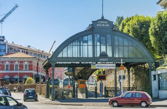
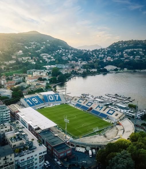
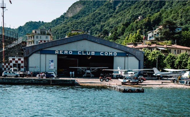
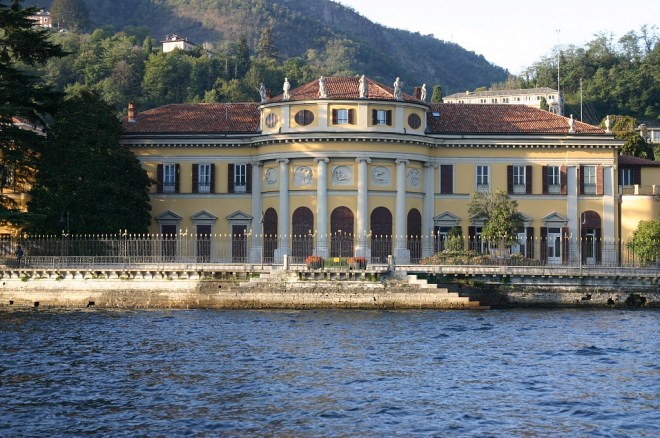
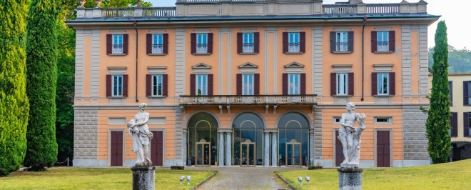
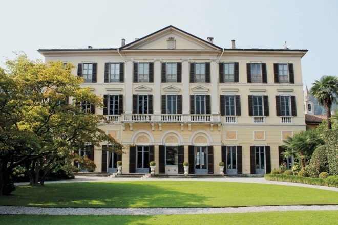
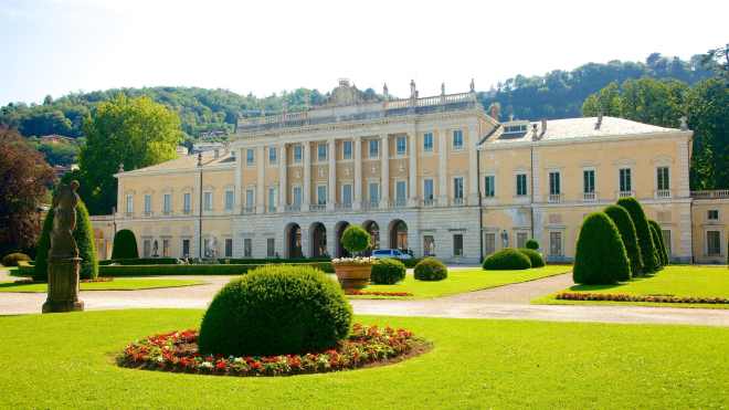
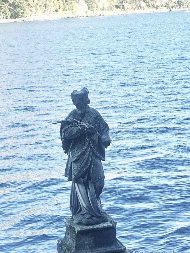
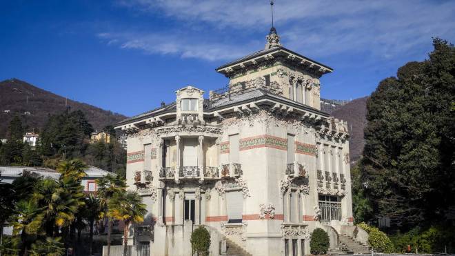
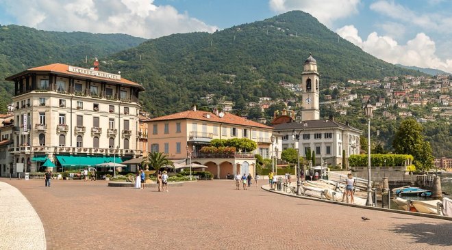
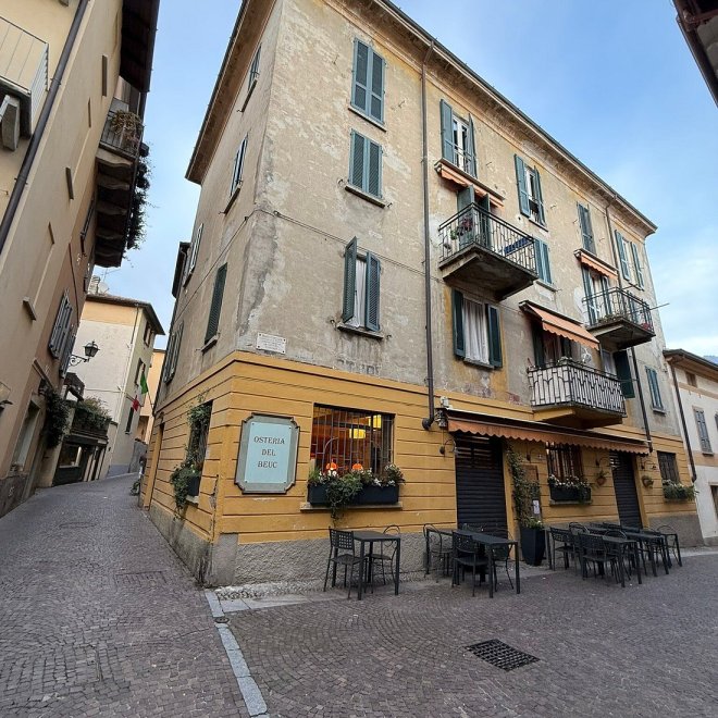
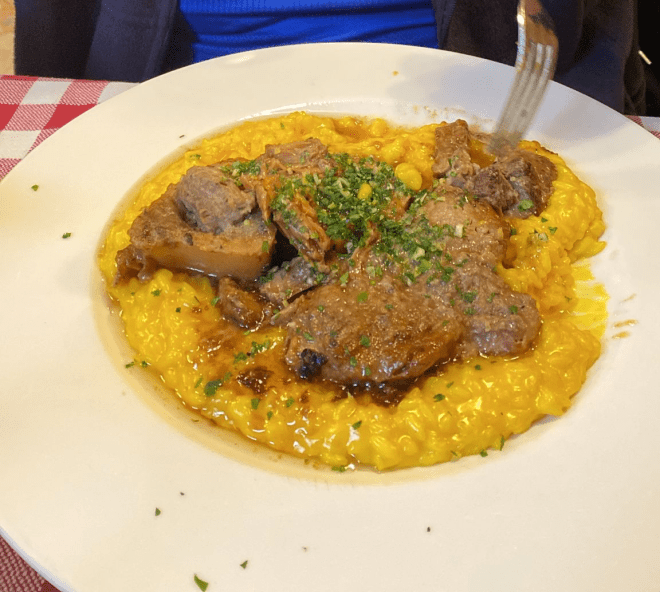
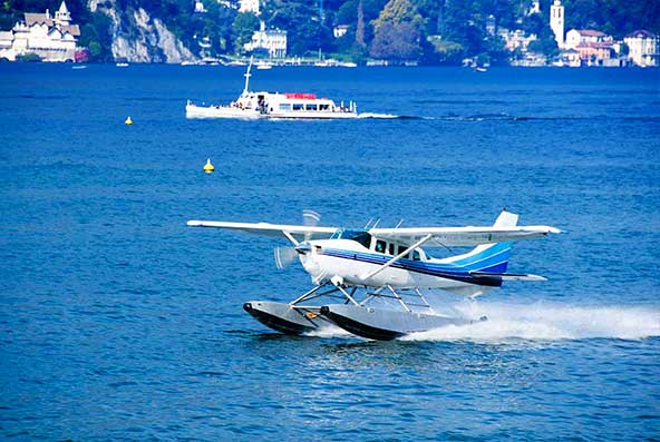
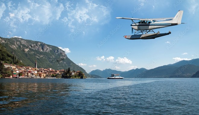
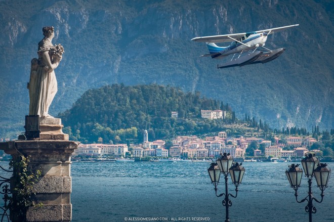
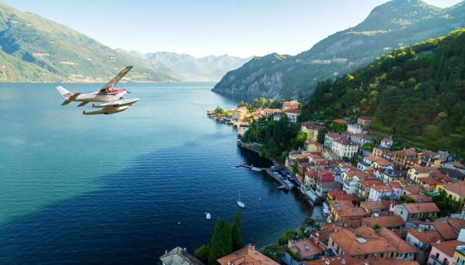
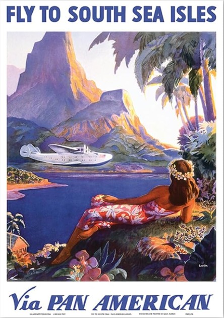
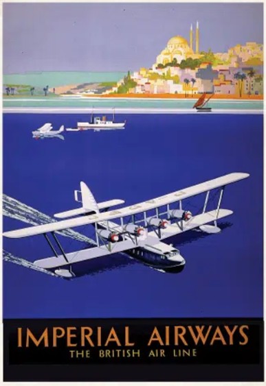
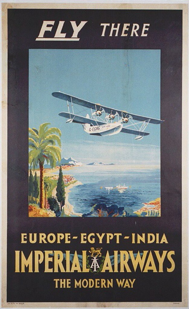


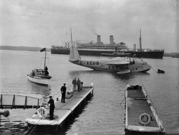


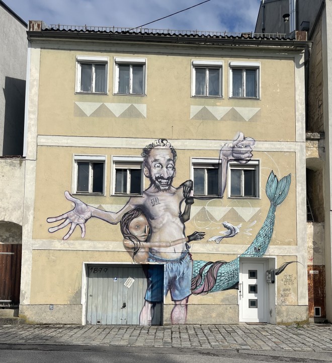


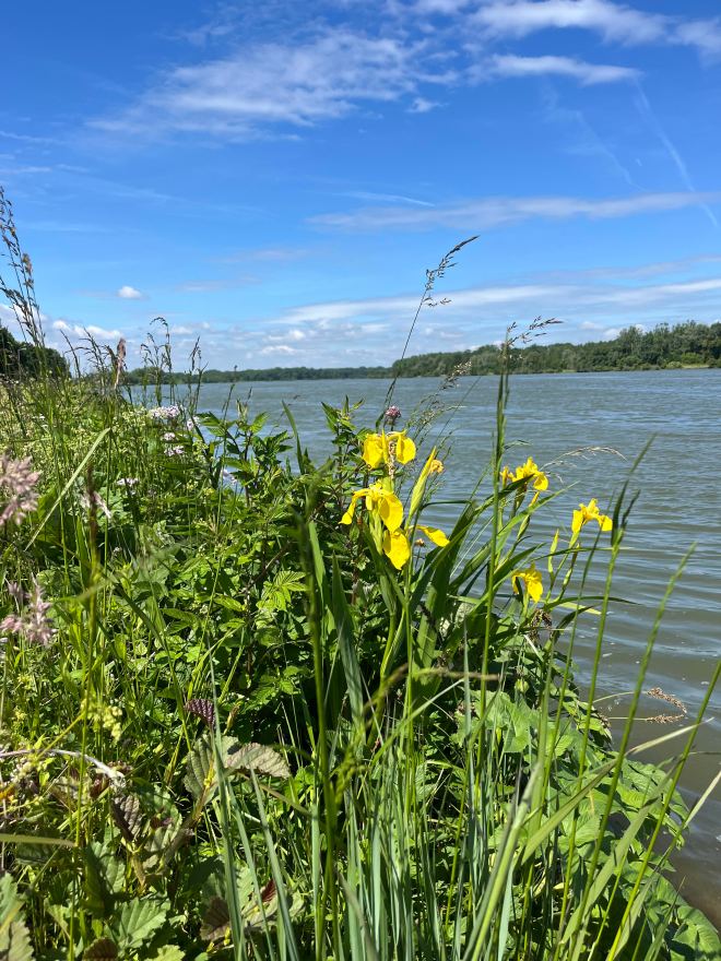
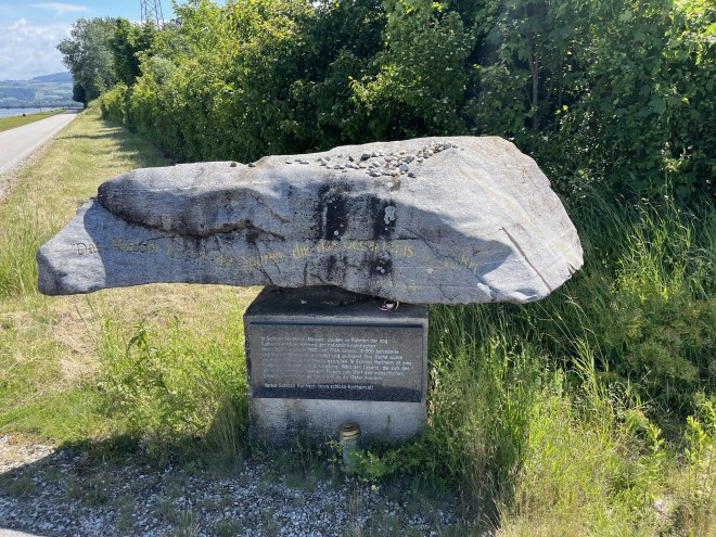


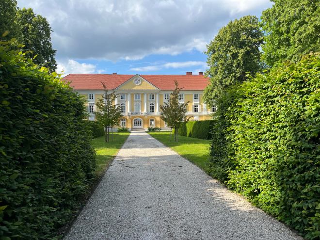


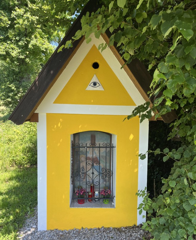
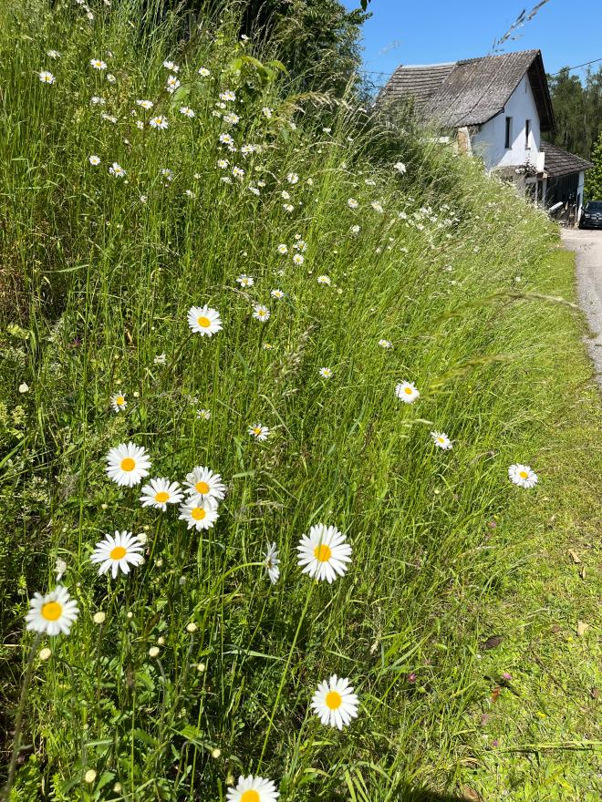


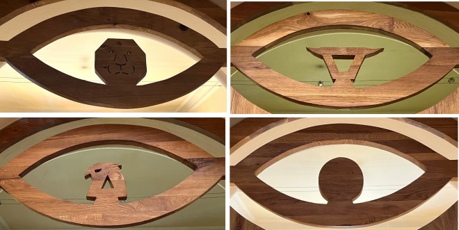
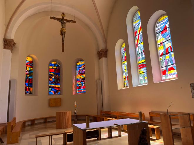
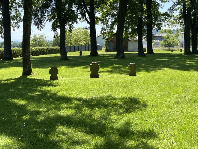


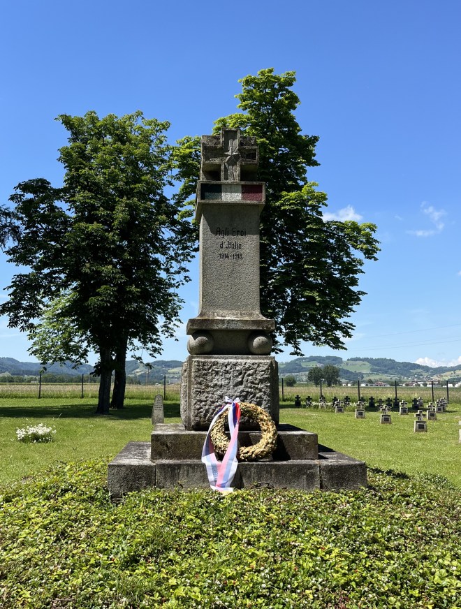
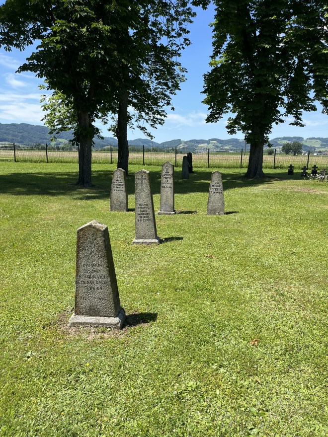

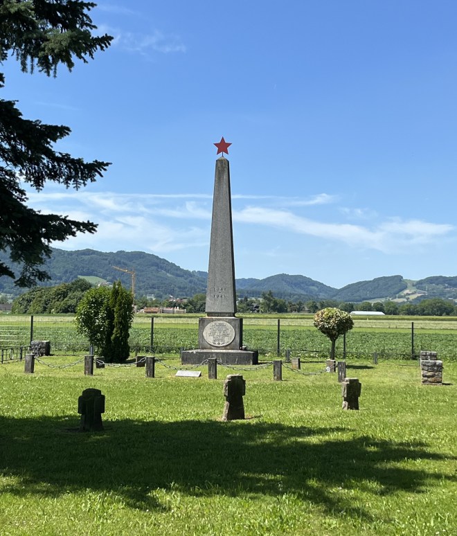

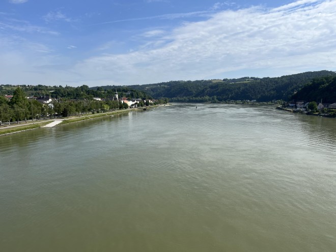

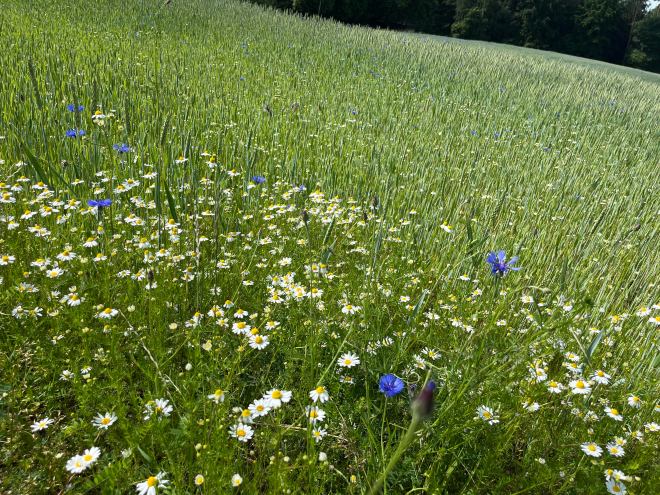
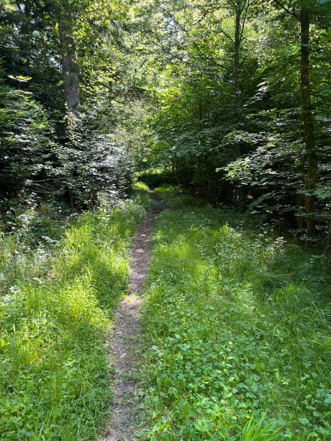
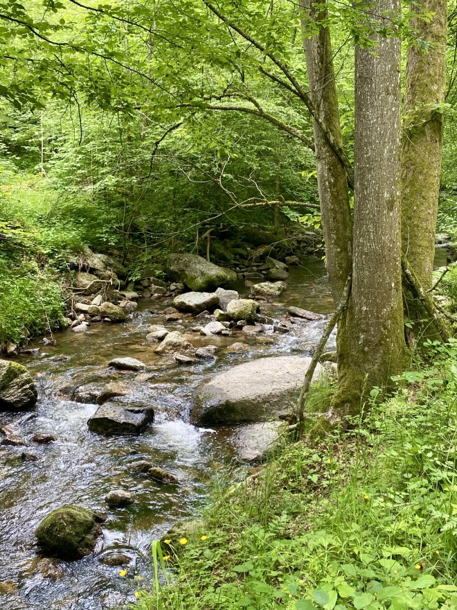


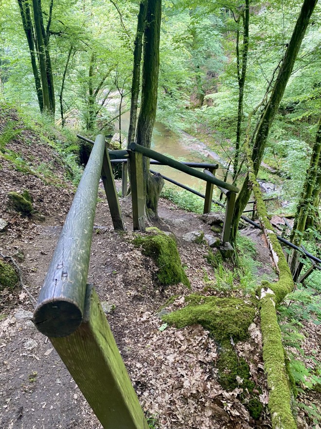
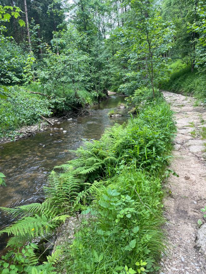


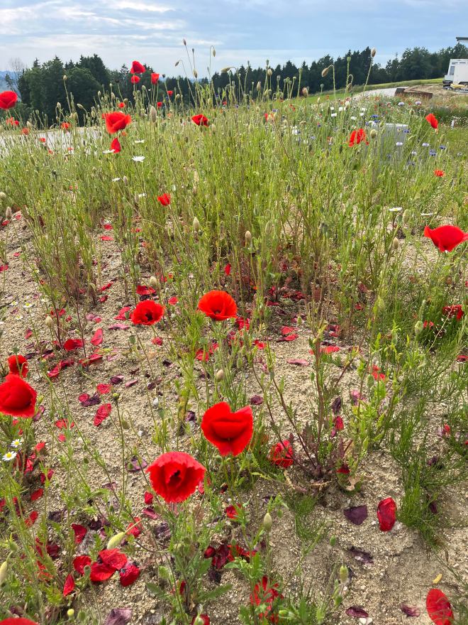


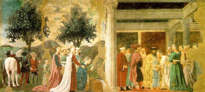
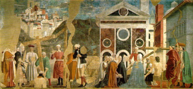


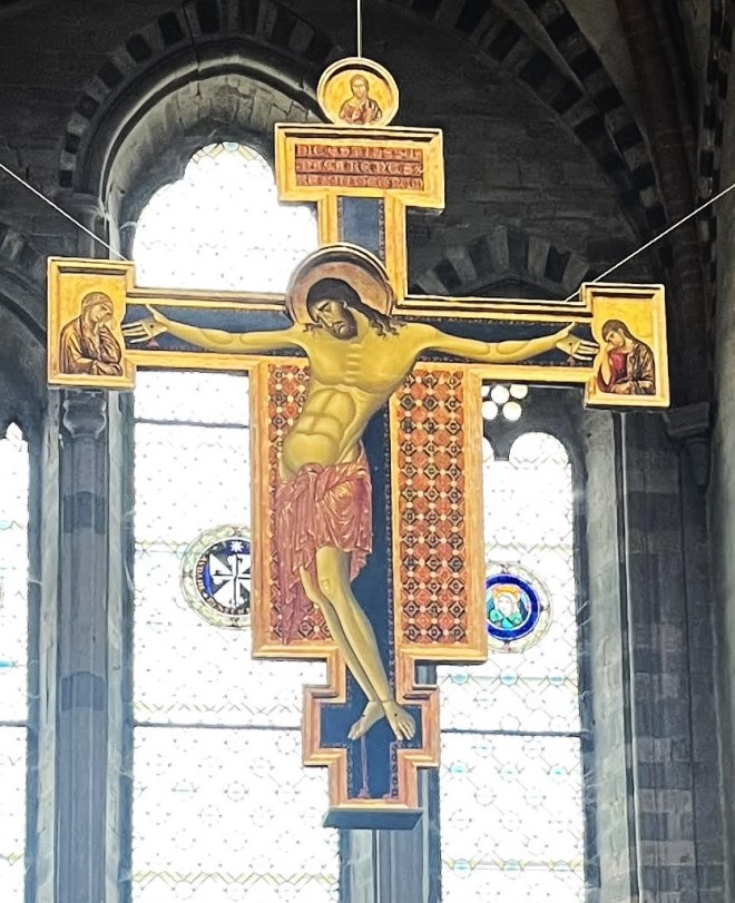
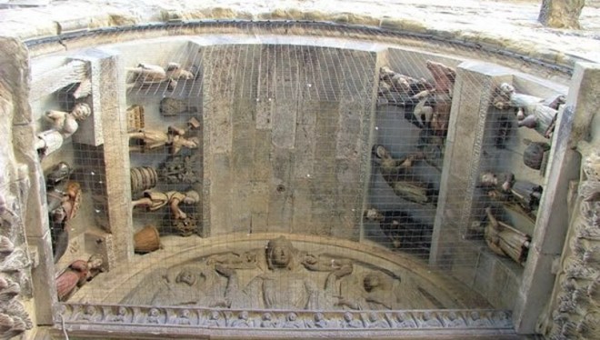
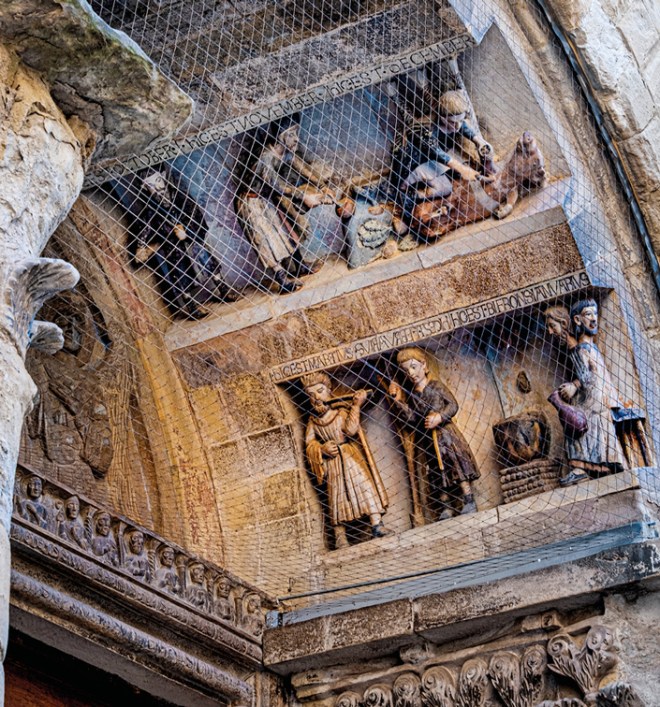
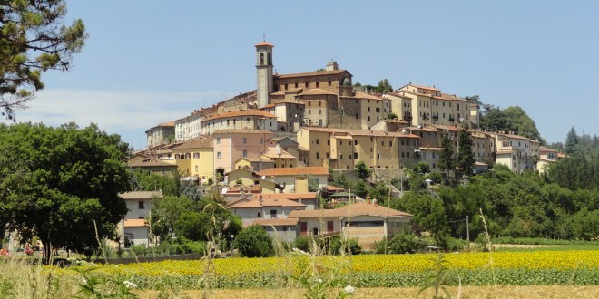


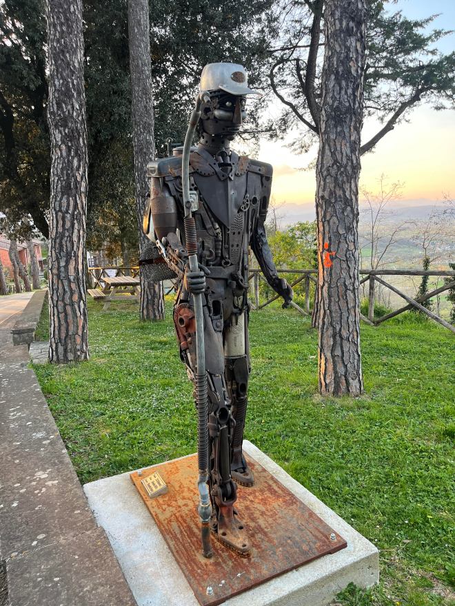


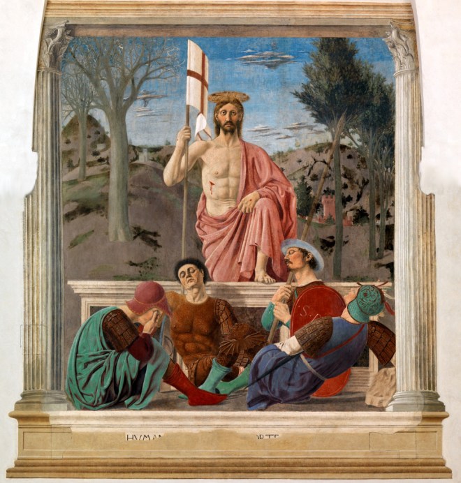
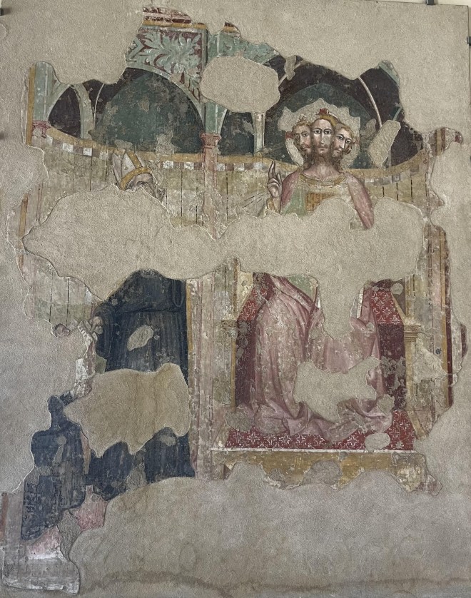


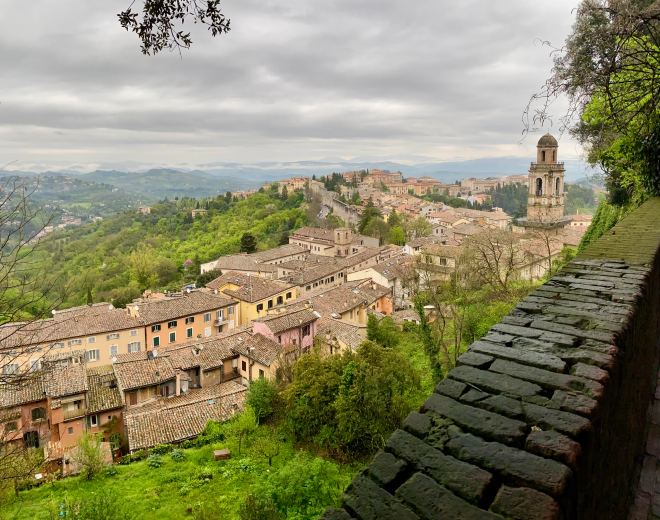
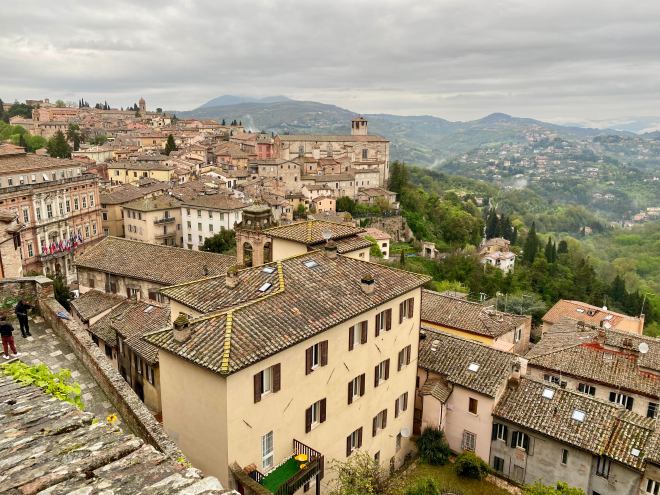
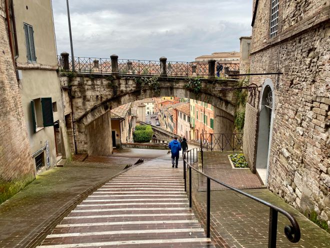

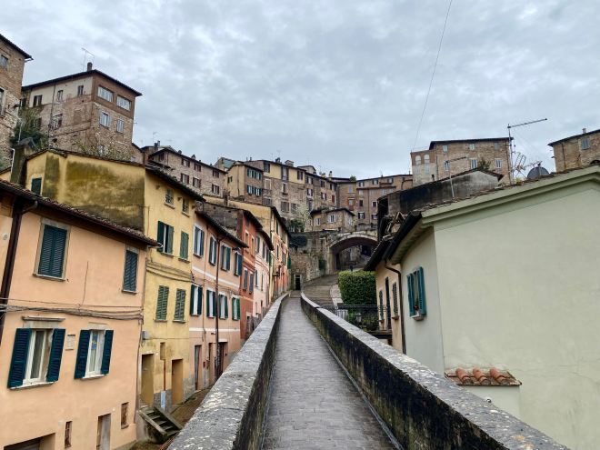

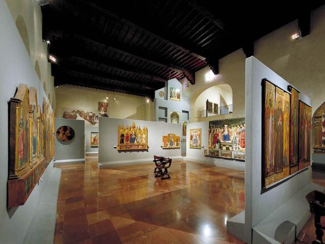
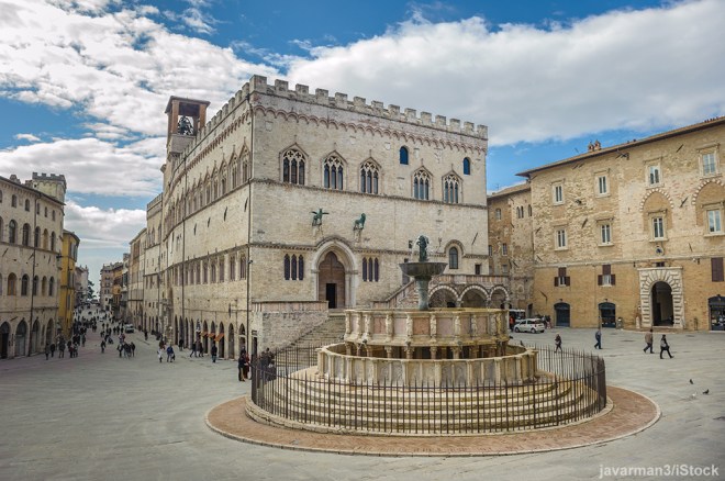


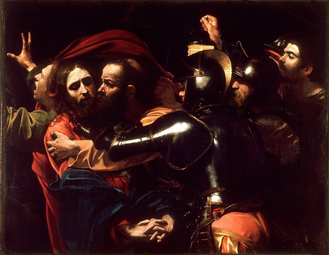


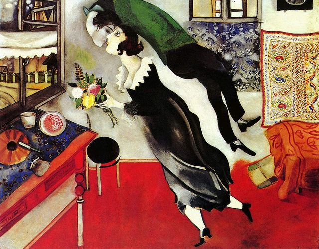
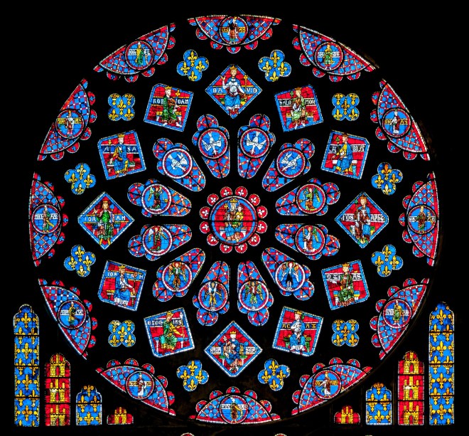


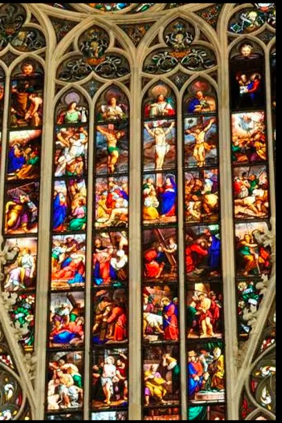


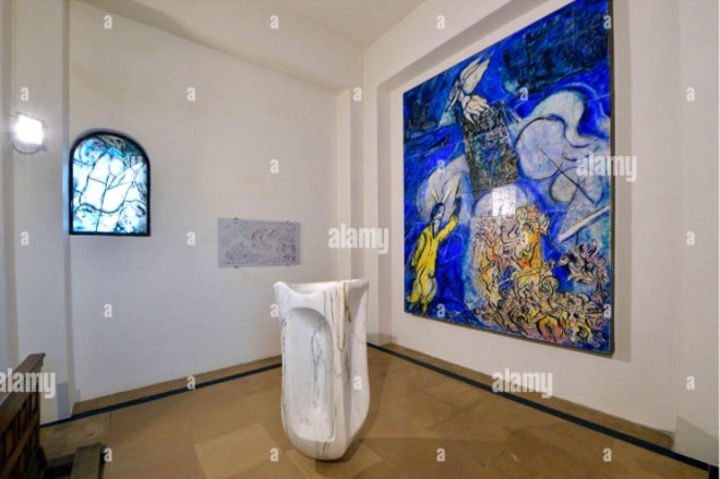

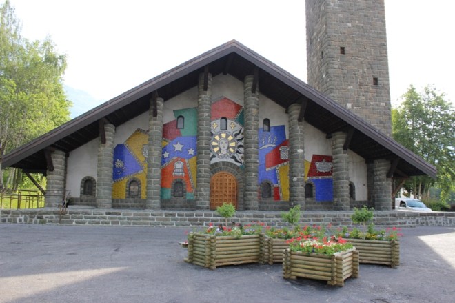


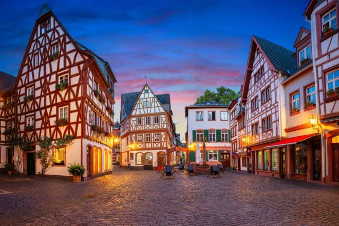


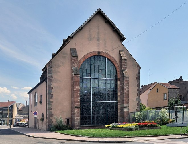

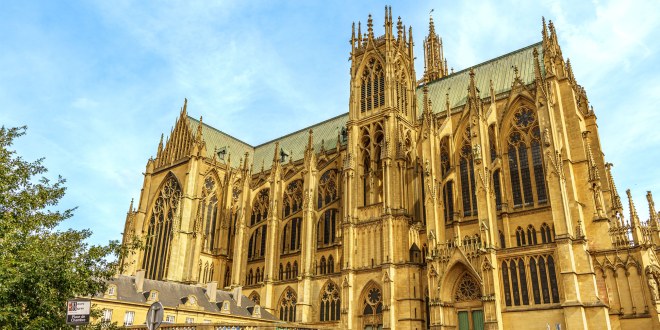


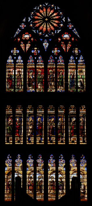
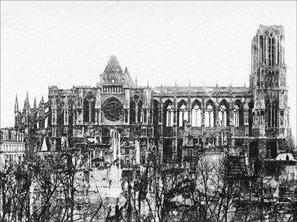
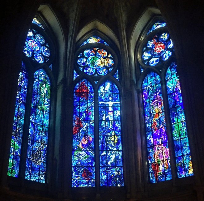

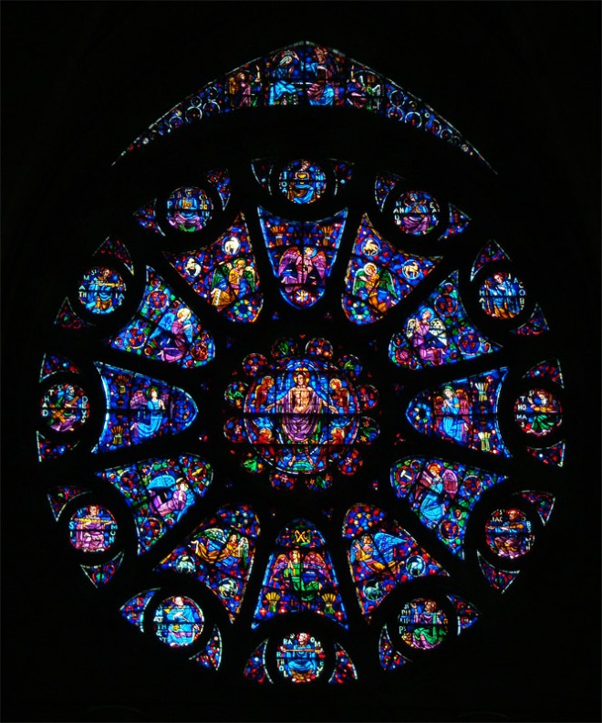
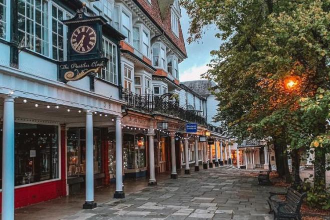
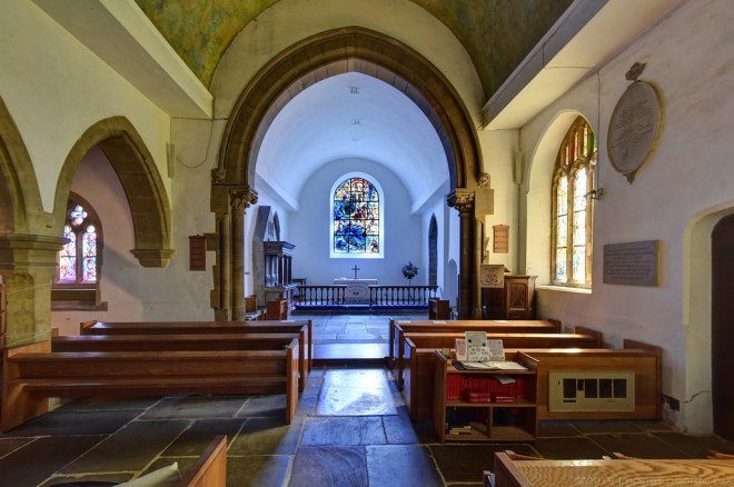
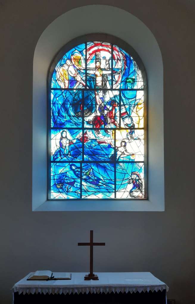


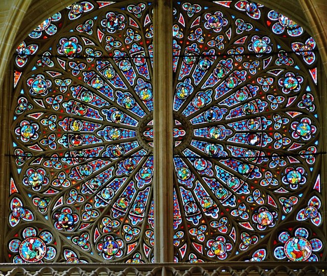

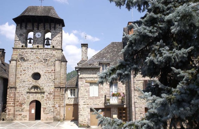


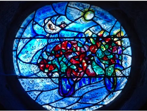


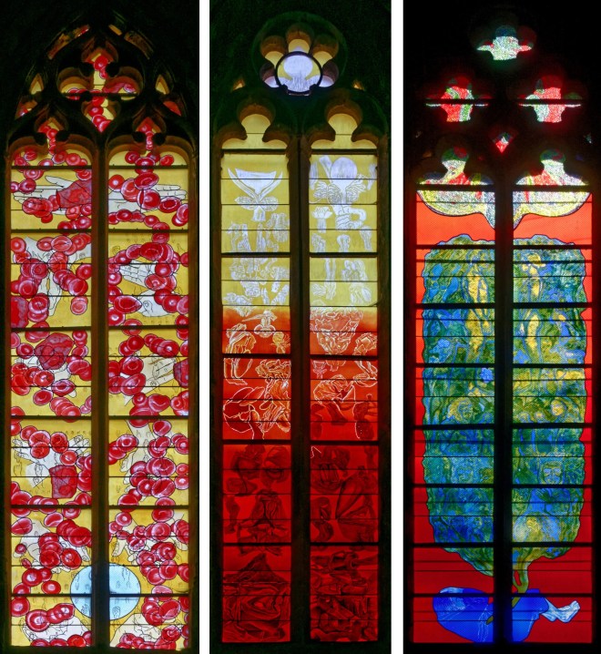


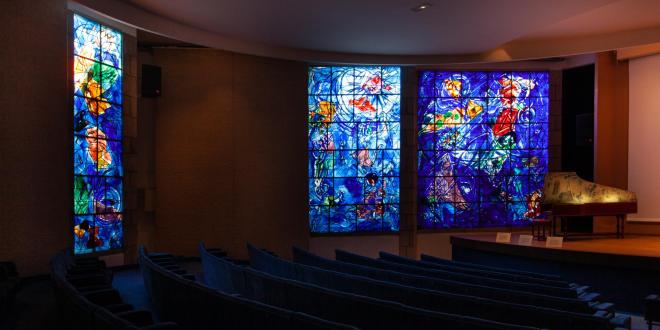


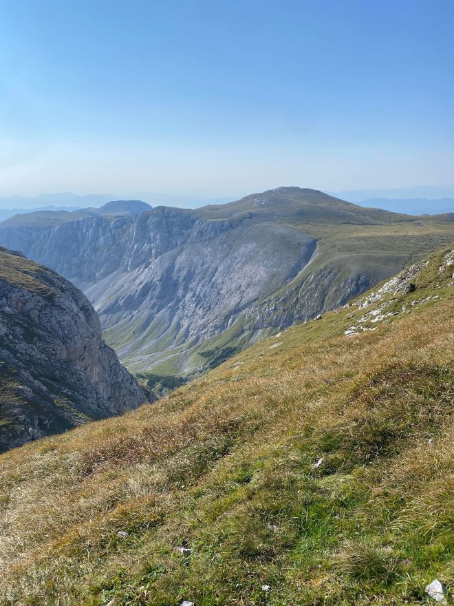


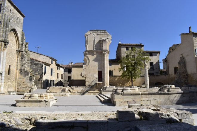


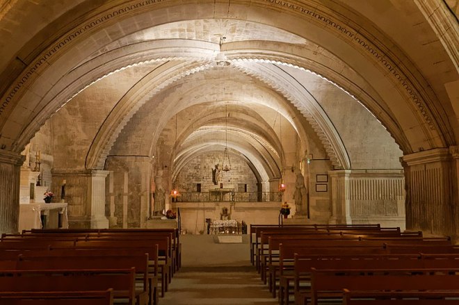
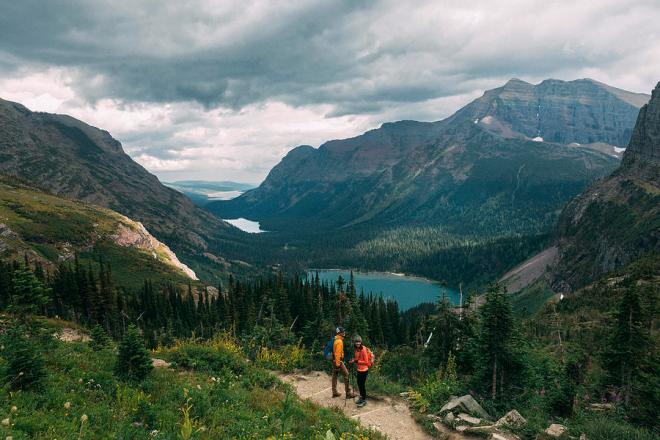


.jpg)