Vienna, 8 June 2025
My wife and I recently completed a four-day hike around the Danube, in the reaches of the river some 20 km upstream from Linz. We started in the village of Ottensheim, made our way to Eferding and then to Aschach, ending the hike in the village of Sankt Martin. I can’t resist inserting here a composite photo I’ve created of the hike.

As readers can see, we wandered rather drunkenly along the Danube.
The wonderful thing about hiking is that you move slowly across the landscape, which allows you to notice things which you probably wouldn’t notice on a bike, let alone a car. I give my readers here a taste of what my wife and I came across – quite serendipitously – as we slowly crossed this Danubian landscape.
Thursday
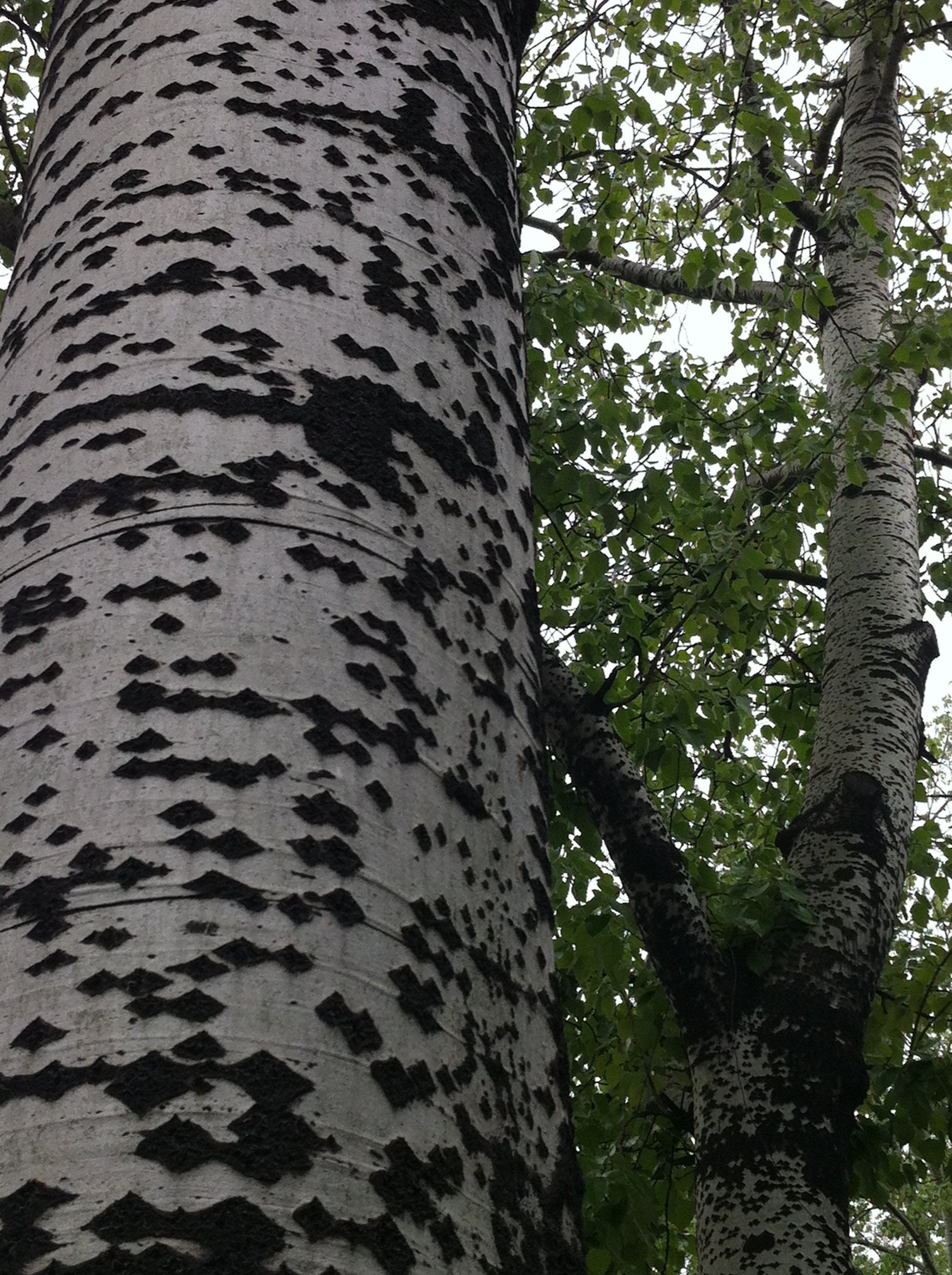
We arrive in Ottensheim, which sits on the Danube river, in the early afternoon. We take advantage of our early arrival to go for a walk on the high lands behind the town. Here is the view of the Danube which greets us at the top. You can see the hydroelectric dam spanning the river. We’ll be passing that dam tomorrow.

We have pizza at the place we’re staying the night, down by the river’s bank. We chat with the staff, all Neapolitans, who all left Naples because of a lack of opportunities there. A story we’ve heard so many times. Such a tragedy for Naples, this steady draining away of their youth.
Friday
We’re greeted at the exit of the hotel by this strange painting on the wall of a house.
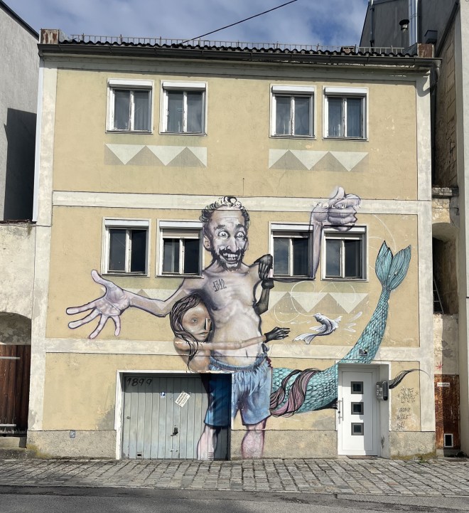
Not sure what happened to the mermaid’s nose …
We’re waiting to board the ferry, which will carry us over to the other bank.

While waiting, we spy a statue of St. Johann Nepomuk, protector of those who cross streams and rivers, so common in this part of the world. This statue is coloured, though, which is rare.

The view from the ferry’s deck, looking upstream. The hydroelectric dam is in the far distance.

We can also see a peek of Ottensheim’s local castle in that last photo. We get a better view as we start walking along the river’s bank.

Its recent history has been quite eventful. Owned by a British family in the 1930s, it was confiscated by the Nazis at the beginning of the war. They used it as a forestry office for the Wermacht. After the war, the Soviets, who occupied that side of the Danube, used it as a barracks. After they left in 1955, when Austria got back its independence, the castle reverted to its pre-war owners. By then it was in a pretty sad state, but its owners didn’t have the money to restore it. It was only in 1988, when the castle was sold to a group of families with deeper pockets, that the castle could be restored. It is still in private hands.
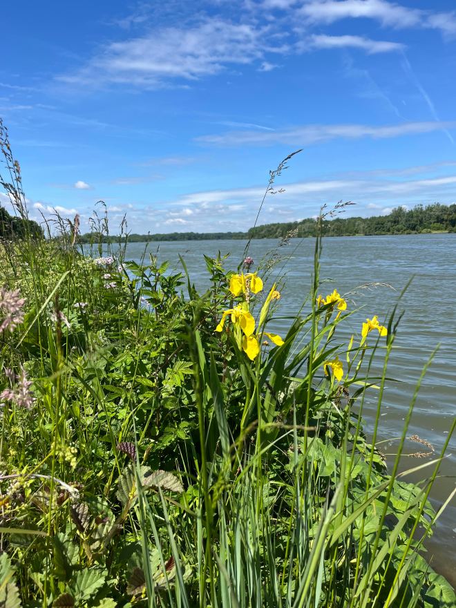
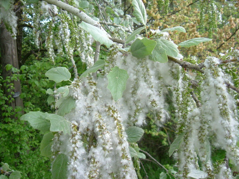
Yellow irises blooming along the water’s edge, the first of many wildflowers we will be seeing on this hike.
Close by, a memorial on the side of the path.
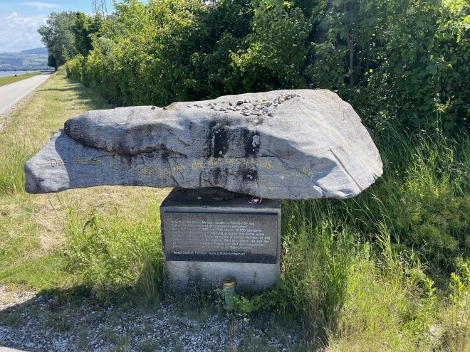
It commemorates the nearly 30,000 people murdered through poisoning with carbon monoxide by the Nazi regime in nearby Hartheim castle, between May 1940 and December 1944. Once their bodies had been cremated the ashes were brought to this spot and dumped into the Danube. Until September 1941, it was a “euthanasia” centre, where 8,000 physically and mentally handicapped people, almost all from Bavaria and Austria, were murdered. After Hitler closed down the Nazis’ euthanasia programme (because of protests from the Roman Catholic Church in Germany), the centre quickly “pivoted” to become a centre for the killing of inmates from nearby concentrations camps, primarily Mauthausen or its satellite camps, who were too sick or injured to work any longer. By December 1944, they had murdered a further 12,000 people, most of them Soviet Prisoners of War.
Wildflowers by the side of the path

Outside a fire station, an intriguing monument to firemen and women, as well as to officers of the Austrian river authority.

An old farmhouse on the edge of the road.

Eferding, the end point of today’s hike, with the parish church’s bell tower dominating the town.

A photo of Eferding’s castle, taken by slipping my iPhone through the big gates that barred entry.
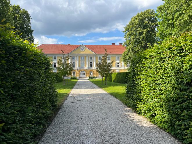
The castle is still owned by the Starhemberg family, who inherited it and the lands that came with it in 1559. Interesting family. They’ve been involved in Austrian politics for the last 1,000 years or so. The latest (in)famous member of the family was Ernst Rüdiger Prince von Stahremberg, who was born in 1899 in the castle and died in 1956 in Voralberg. He was a right-wing politician with great admiration for Mussolini’s fascism. He served in Austria’s right-wing governments from 1930 until 1936. Although fascistic, he really disliked the Nazis and made his dislike very public, so after the Anschluss of 1938 he fled to Switzerland to avoid vengeful retaliation by the Nazis (and perhaps also to protect his wife, who was Jewish). At the beginning of World War II, he served in some capacity in the British and Free French Air Forces, but he resigned in disgust after the UK and the US allied themselves with the Soviet Union in 1941 – he viewed communism and Nazism as equally evil. Thereafter, he and his wife left for Argentina; not unnaturally, he felt a great affinity with the politics of Juan Peron. In 1956, after Peron had been ousted by the army, he travelled to Austria for an extended visit, no doubt to explore the possibility of coming back. He was staying at a spa in Schruns (the bell tower of whose parish church I had so admired last year). During a walk, he was photographed by a journalist who worked at a communist newspaper. In a rage, he attacked the journalist with his walking stick, but this triggered a cardiac arrest and he died there on the pavement.
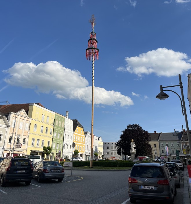
Turning my back on the Stahremberg castle, a view of Eferding’s main square

with its maypole still standing
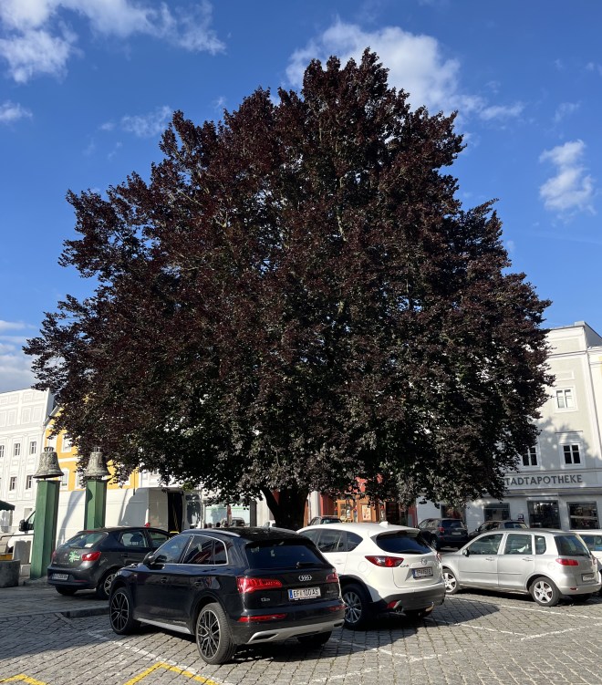
and a magnificent copper beach at the far end.
Eferding’s parish church

with its beautifully carved pulpit (although not as beautiful as the one my wife and I saw in Traunkirchen several years ago)

and the tombstone of some long dead knight.

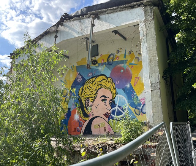
A Lichtenstein-like mural on the wall of a ruined house
An amusing ad for a shop offering orthopaedic services.

And so to dinner and bed.
Saturday
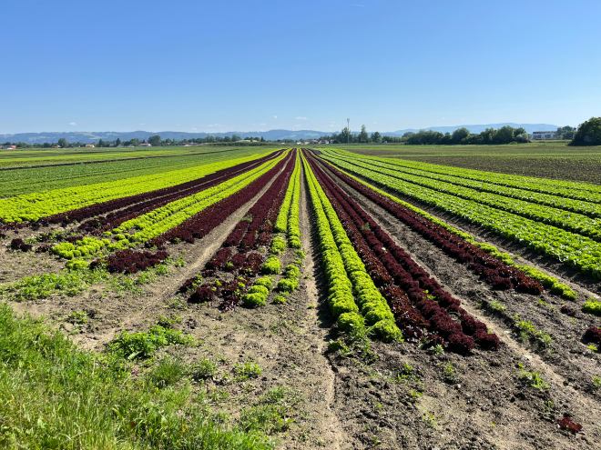
We start the day by walking over the rich farmland around Eferding. We pass these multicoloured rows of lettuces.
We go past a garden whose owner must be an amateur sculptor with a fondness for using scrap metal.
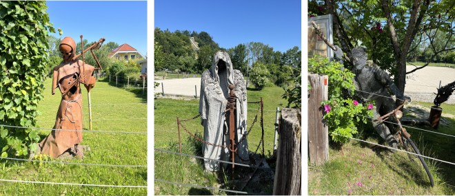
Nearby, beauty among the garbage.

We begin to climb a steep ridge. We pass a shrine on the side of the road.
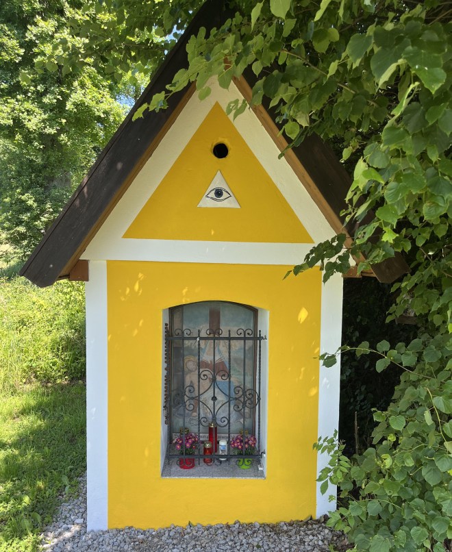
Shrines are common throughout Austria, but I notice that in this region shrines – like this one – have an eye painted on them. I suppose it represents God, the “All-Seeing Eye”. But I find it rather unnerving: “You can’t hide from me, I can see everything that you do” – just like Big Brother in George Orwell’s “Nineteen Eighty-Four”.
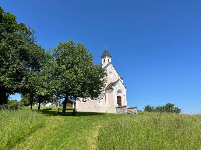
A chapel at the top of the ridge.
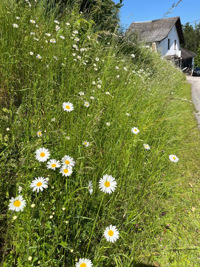
A spray of daisies on the side of the road.
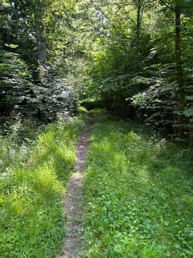
We plunge into the woods.


A view over the plain around Eferding.

We come down the ridge and pass the small airfield – literally, in this case – of a gliding club.

We have been watching the gliders soaring over us all morning; my iPhone, alas, cannot capture their ethereal beauty.
We look back at the ridge we walked along, with a castle ruin sitting on it.

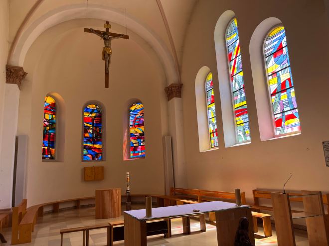
We stop for lunch in the village of Pupping, finding a bench in the parish church’s garden to sit on. I, of course, cannot pass up the opportunity of visiting the church after lunch. I find a mix of old and new.
A statue of St. Wolfgang, who, it is said, died at the altar of the (original) church in 994 CE.

A statue of St. Christopher, looking less than pleased with having to carry the Child Jesus.

Four carved door lintels, displaying the symbols of the four Evangelists: clockwise from the top left, the lion of St. Mark (you have to look hard to see the lion’s face), the ox of St. Luke, the angel of St. Matthew, and the eagle of St. John.

It takes me a while to understand that Luke’s angel is represented by an eye – the eye again …
Rather pleasant stained-glass windows.
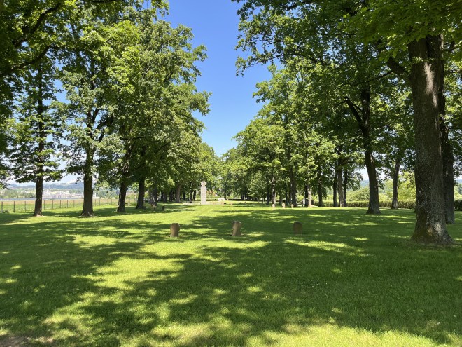
We continue the hike towards our end point today, Aschach, on the Danube. Quite by chance, our route takes us past a war cemetery.
It has the look and feel of the German war cemeteries which my wife and I had visited on the Western Front: tall oak trees, shading a lawn, in which are planted stone crosses.
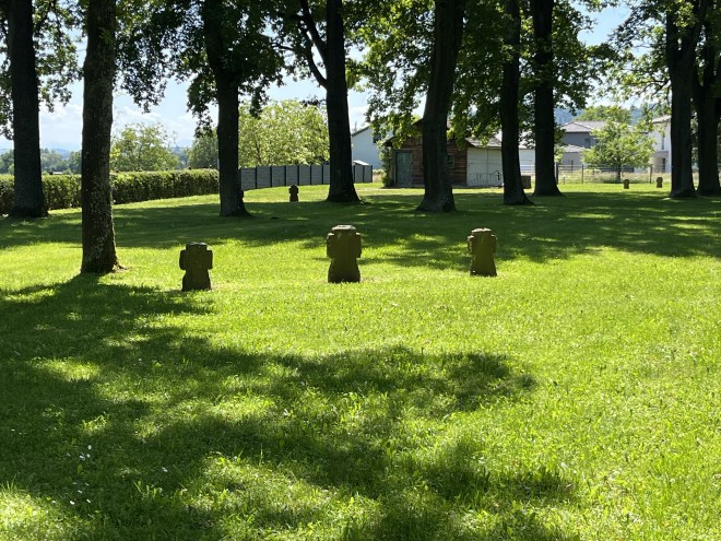

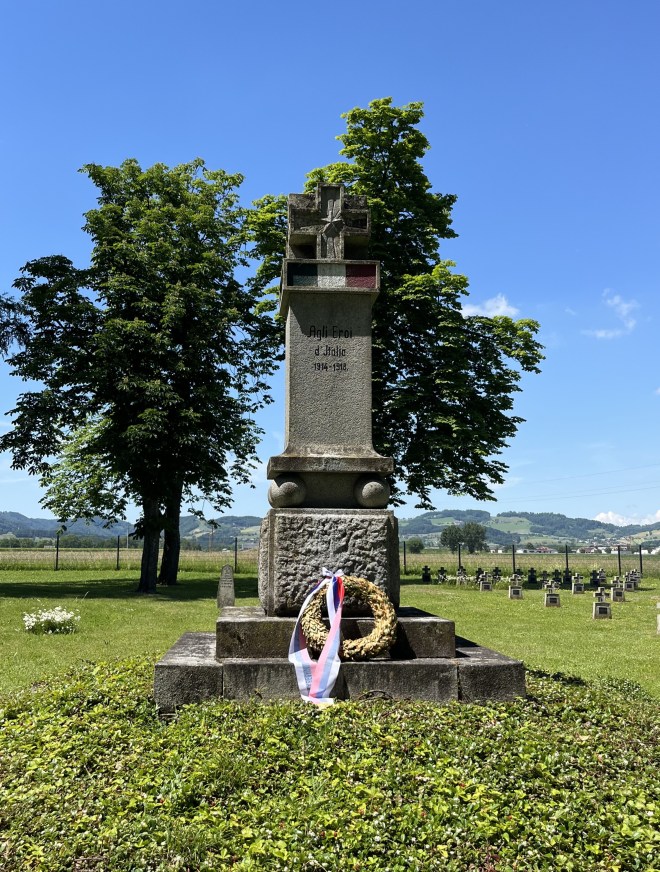
But actually, although the cemetery is looked after by the German association for war graves (hence the look), none of the soldiers buried there are Austrian or German. And none of the dead who are commemorated fell on the frontline; they were all prisoners of war who died in a POW camp which the Austro-Hungarians built close by for use during the First World War. They were mainly Italians

with their memorial
and Serbians
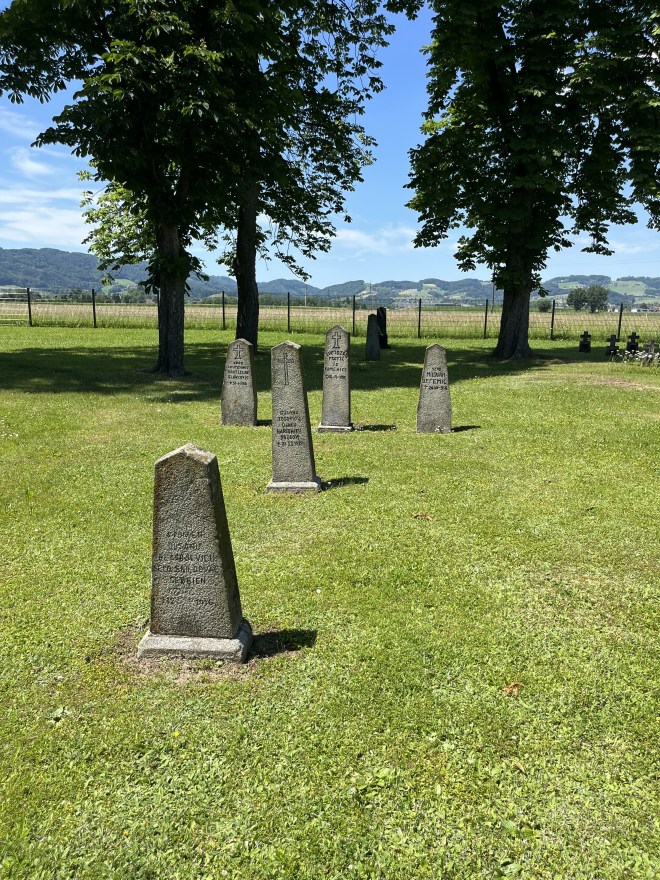
with theirs.

After the Second World War, the Soviets put up a memorial to their POWs who had been murdered in Mauthausen and other nearby concentration camps.
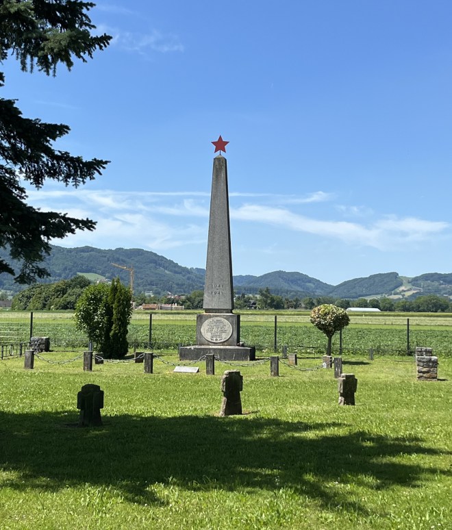
Of course, the thousands of murdered Soviet POWs didn’t get an individual grave, their names were not even inscribed on a monument. But some Russian family had come and attached a photo of one Soviet prisoner to a stone cross, with the epitaph “We remember, we love, we grieve. The grandchildren”.

We walk on to Aschach.
Sunday
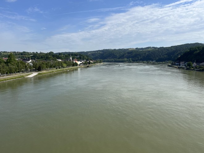
We start the day by once again crossing the Danube, but this time using a bridge rather than on a ferry.
Some purple irises catch my eye as we walked along the river bank.

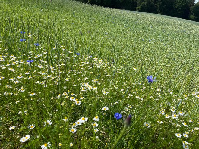
We climb up to the high lands overlooking the river, past fields of wheat studded with corn flowers and daisies.
We enter the woods.
The path eventually leads us off the high lands and down to a stream at the bottom of a valley. We start following the stream towards its source. At first, the stream cheerfully burbles along.
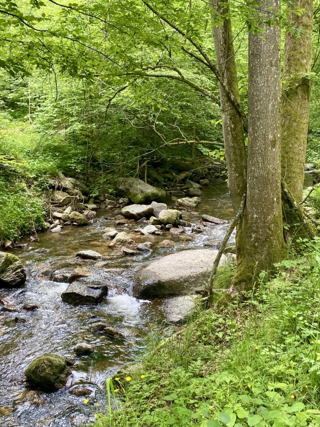
But soon the stream bed becomes rough as stones from above have tumbled down, and the water jumps around.


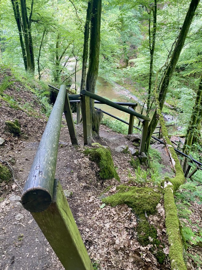
The path mimics the roughness of the stream.
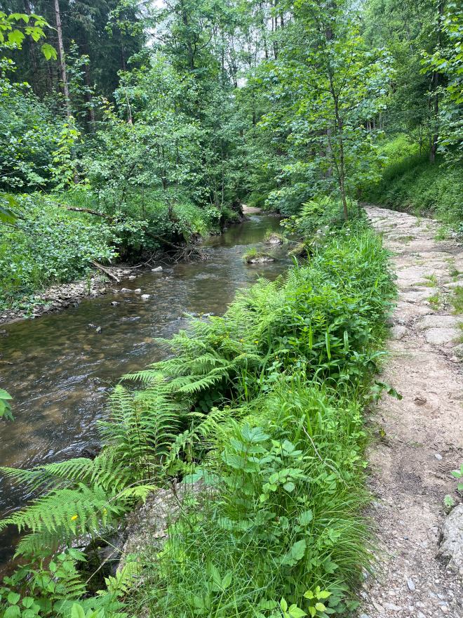
Once we reach the high lands, the stream quietens down, the path likewise.
We pass meadows along the stream’s banks. Some have been turned into lawns.

Here, another anonymous sculptor has turned a tree trunk into a whimsical totem pole.

One of the meadows is carpeted in pink flowers.

Finally, we leave the stream and climb up onto a ridge. An alpine pasture falls away to our right. It is impossibly green.

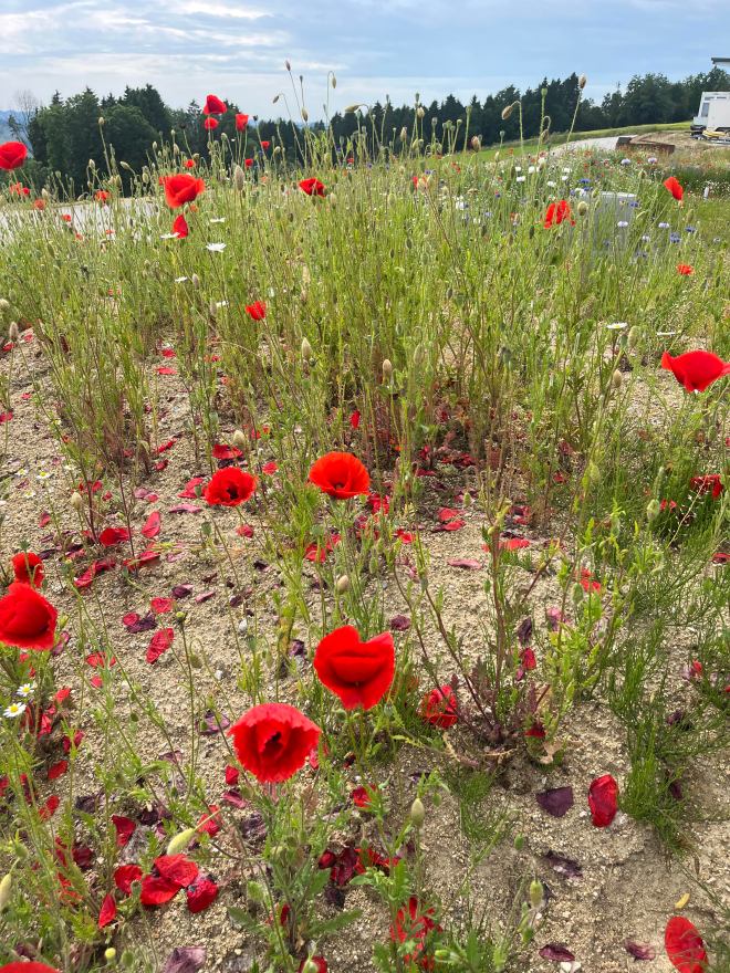
We pass through Sankt Martin and start walking along a main road. This is the only way to our hotel. We pass a building site, where a riot of poppies grow: beauty clothing the ugliness.
We reach the hotel. Our hike is finished.


