AMBER AND ITS ROAD

Bangkok, 15 August 2016

I’ve just finished a fascinating book about the peopling of Europe, entitled Ancestral Journeys: The Peopling of Europe from the First Venturers to the Vikings, by Jean Manco. The book describes the various waves of people who have settled Europe, peacefully or not, from 40,000 BC to 1,000 AD.

One thread in the rich tapestry of the peopling of Europe is the trade networks which sprang up as neighbouring tribes traded whatever useful or interesting resources they controlled inside their territories. The really high-value resources could in this way travel very long distances from their point of origin, as people passed them on – at ever-increasing value, no doubt – to people further away from the original source. In an earlier post, I’ve mentioned the Stone Age long-distance trade in obsidian, which made excellent, sharp arrowheads. Gold, the subject of my next-to previous post, was also traded over long distances. Amber was another such material.

In the early days of Europe’s history, by far the richest source of amber was the Baltic coast of Poland (it probably still is), where nuggets of amber would wash up on the beach, broken off from the amber deposits on the sea bottom.
image
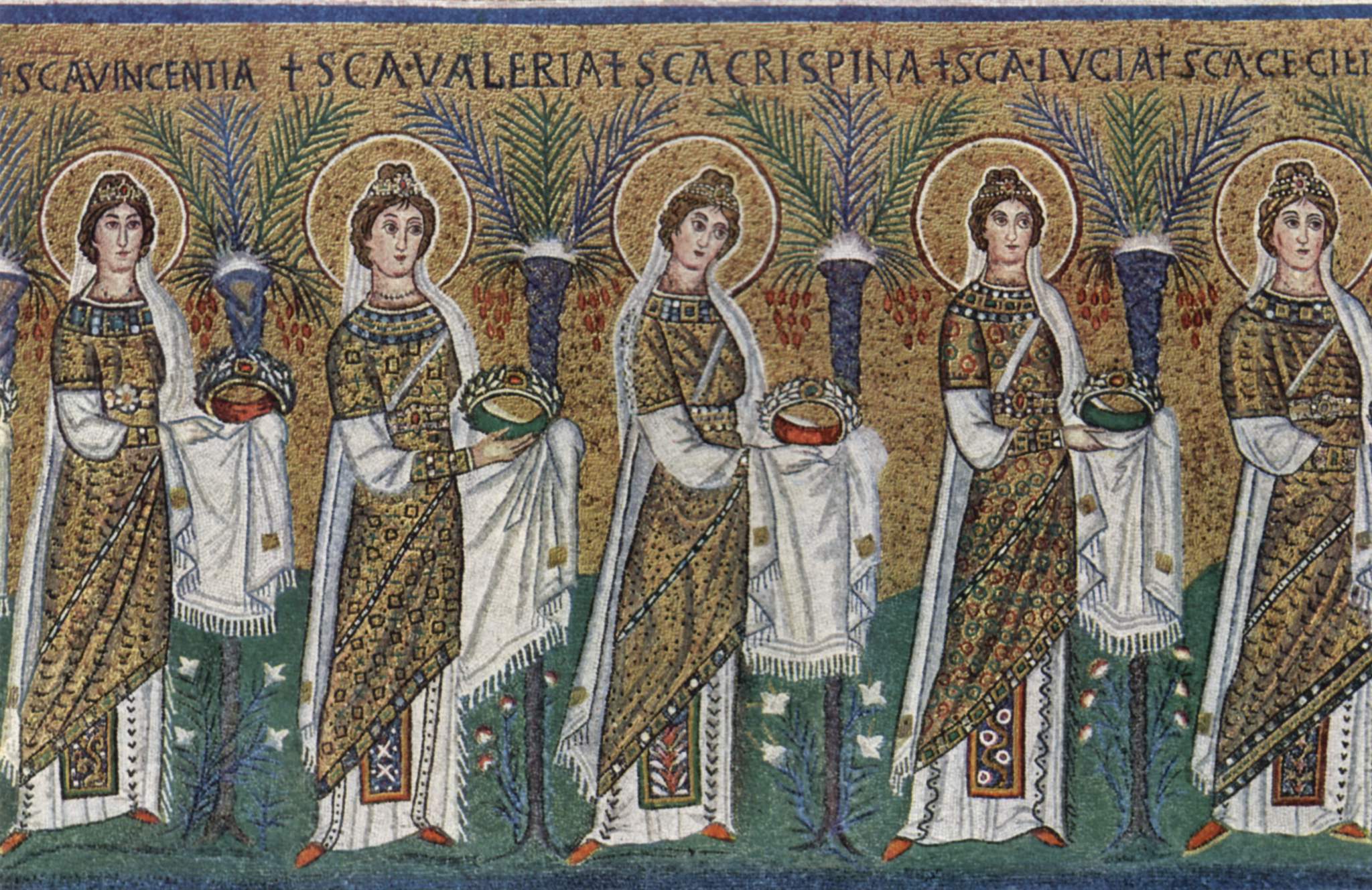
The biggest market for amber, on the other hand, and from time immemorial, were the civilizations around the Mediterranean Sea and in the Middle East. Tutunkhamun’s breast ornament contains pieces of Baltic amber, for instance
image
while Heinrich Schliemann found necklace beads of Baltic amber in the Mycenaean tombs he excavated.

Thus sprang up several “amber roads”, trade routes which brought Baltic (and other Northern European) amber south.
image
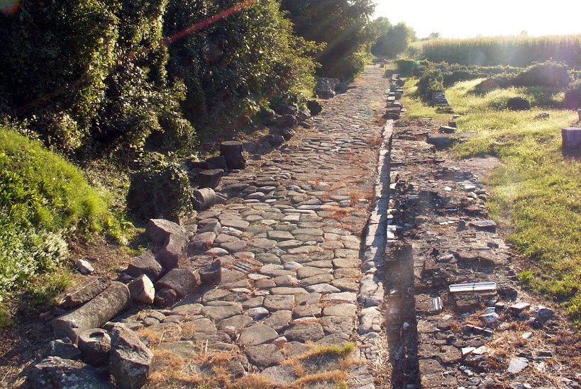
The one that most interests me is the amber road which led from the general region of Gdansk down to the Roman provincial capital of Carnuntum on the Danube River (the Danube became the Roman Empire’s frontier in 9 BC), on down along the network of Roman roads to Aquileia in North-Eastern Italy, the terminus. This map shows, more or less, a detailed trace of this amber road.
image
I say “more or less” because while the route taken by the amber after the Danube River crossing is pretty clear – it followed the Roman roads down to the Italian peninsula – how it got to the Danube River from the Baltic coast is less so. There were just tracks through the forests and around the bogs in this part of Europe, and I’m sure every Germanic trader followed his fancy, depending on what else he was buying or selling along the way, as well as what the weather was like and who was fighting who. There seem to have been a few fixed points on the itinerary: Wroclaw (Breslau in German; the British historian Norman Davies, in collaboration with Roger Moorehouse, has written a fascinating biography of this city, Microcosm: Portrait of a Central European City), the Moravian Gate (a pass between the Carpathian and Sudeten mountains, used since remotest antiquity as a passageway), and the Morava River which flows into the Danube just across from Carnuntum.

Once the raw amber arrived in Aquileia, it was turned over to workshops which turned it into desirable luxury products. Aquileia’s amber products were famous not just in the Italic heartlands but throughout the Roman world. In his Natural History, Pliny the Elder – rather dismissively, it seems to me – says they were in demand among women only. He also says that amber was thought to have protective properties for illnesses of the throat, which might explain why so many of the amber products found in the Italian peninsula are pendants.

I have to say I’m not a big fan of amber, at least as used in modern jewelry. But I must admit that some of the amber pieces made in the Italian peninsula, both before its domination by Rome and after, are really very lovely. Here, in no particular order, are some pieces whose photos I found on the net. The first two are pre-Roman (Italic and Etruscan, respectively, to be precise)
image
image
while the remainder are from the Roman period; a number of them, if not all, were made in Aquileia’s workshops. This is Dionysius
image
while this must be Pan.
image
This is a perfume bottle
image
while this little set-piece is “Eros and a bitch”.
image
Lovely little pieces …

Let me go back a step now and explain my interest in this particular amber road. Or rather interests, for there are several. I first got to know about it, and the ancient amber trade in general, when my wife and I lived in Vienna. It so happens that Vienna is located close to Carnuntum. It always tickled me pink to think that Vienna, which gives itself such airs as the capital of the (defunct) Austro-Hungarian Empire, was once upon a time no more than a minor garrison town called Vindobona on the far edges of the much mightier Roman Empire. I’m sure officers and soldiers alike in little Vindobona looked with envy at their more powerful neighbour Carnunutum, which not only had the rich amber trade passing through it but also was the capital of the province. So many more important things went on there! The Emperor Marcus Aurelius chose Carnuntum as his base for three years during one of the periodic Roman campaigns against Germanic tribes across the Danube River (he also wrote part of his famous Meditations there, a copy of which graces my bookshelves). Another Emperor, Septimius Severus, was also based in Carnuntum when governor of Pannonia, and he was proclaimed Emperor there by his troops. Carnuntum hosted a historic meeting between the Emperor Diocletian and his co-emperors Maximian and Galerius, to solve rising tensions within the tetrarchy. Among other things, the meeting led to freedom of religion for the Roman Empire. And on, and on.

In contrast, like in all garrison towns, probably nothing much ever happened in Vindobona (although Marcus Aurelius’s death there in 180 AD must have caused a ripple of excitement). W.H. Auden caught well the tedium of garrison life on the Empire’s frontier for the ordinary soldier, in his poem Roman Wall Blues. The poem is about another of the Empire’s frontiers, Hadrian’s Wall, but I’m sure the tedium was the same, whichever frontier you were assigned to.

Over the heather the wet wind blows,
I’ve lice in my tunic and a cold in my nose.

The rain comes pattering out of the sky,
I’m a Wall soldier, I don’t know why.

The mist creeps over the hard grey stone,
My girl’s in Tungria; I sleep alone.

Aulus goes hanging around her place,
I don’t like his manners, I don’t like his face.

Piso’s a Christian, he worships a fish;
There’d be no kissing if he had his wish.

She gave me a ring but I diced it away;
I want my girl and I want my pay.

When I’m a veteran with only one eye
I shall do nothing but look at the sky.

But I suppose Vienna had the last laugh. It still exists, whereas Carnuntum is now but a very modest pile of ruins, having been systematically sacked by Germanic tribes in the 4th Century (I suppose in a way the Germanic tribes had the last laugh too, after all the denigration they received from the Romans). Sic transit gloria mundi, as I am ever fond of repeating: “thus passes the glory of the world”.

This particular amber road also caught my attention because it gave me an alternative route to the ones we always took to go back to my wife’s home town of Milan: either head south out of Vienna over the mountains to Graz and then over more mountains to Klagenfurt and Villach, slip through the Alps at the Tarvisio pass, then speed past Udine down to Venice, whence turn right and make for Milan; or, head west out of Vienna towards Linz, then Salzburg, and then into Bavaria, turn left at the River Inn and enter Austria again, at Innsbruck turn left again and climb up to the Brenner pass, down the other side to zip by Bolzano and Trento, exit from the Alps at Verona, and turn right there to head for Milan. Now my wife and I could take a lower road (a considerable benefit when traveling in winter, when both the other routes can be unpleasant), as well as one steeped in history. Travelling along the ghosts of old Roman roads (all of which disappeared long ago) we would head south past the tip of Lake Neusidler, shared by Austria and Hungary, to Šopron and then Szombalethy, both in Hungary, on to Ptuj, Celje, and Lubljana in Slovenia, to finally slip through the Julian Alps at Gorizia and on to Aquileia, where we would need to finally get on the A4 motorway and speed on to Milan!

Great idea, except for one slight problem – time. There is no speedy highway linking all these towns, so it would take far longer to get to Milan. Since we were working, we couldn’t afford the time; we were always time-starved. But that will all change in a mere two weeks’ time, when I retire! Then, we will have all the time in the world, and I am determined to finally follow in the footsteps of the legions and pass through what were once the Roman towns of Scarbantia, Savariensum, Poetovium, Celeia, and Emona. There’s not much Roman left in them, though. Like Carnuntum, and like the terminal point Aquileia (of whose total destruction I wrote about in an earlier post), they were all thoroughly sacked and resacked by Germanic, Gothic, Hun, Lombard, Slav, or Hungarian war parties (or some combination of these) during the period of the “Barbarian Invasions” or the “Migration of the Peoples”, the Völkerwanderung (take your pick, depending on your ideological point of view).

I always feel a point of melancholy when faced with these moments of destruction in history. And it’s not just in the remote past. On the northern end of this amber road, tremendous destruction, of places but also of people, was wreaked a mere 70 or so years ago as first, German troops swept through on their way to enacting Hitler’s policy of lebensraum, expanding the living space of the Aryan, Germanic people at the expense of Slavic people, and then again, as the Soviet troops fought their way back to Berlin. Along with many other Polish cities, Gdansk, Wroclaw, Poznan, all sitting astride the amber route, were almost totally destroyed, their Jewish populations annihilated, their Polish populations much depleted, their industrial infrastructure stripped away. What a waste … so much human creativity swept away by the animal desire to destroy.

_________________
Raw amber on a Baltic beach: https://en.m.wikipedia.org/wiki/Baltic_amber#/media/File%3ABaltic_beach_sand_containing_amber.jpg
Tutunkhamun’s breast ornament: https://hu.pinterest.com/pin/249598004324238999/
Amber necklace, Mycenae: https://sites.google.com/site/ambranathistplinio/home/etimologia-e-proprieta
Amber routes map: http://www.ambergallery.lt/en/disp.php?itm=en_museums_3%2Fen_museums_3_9
Amber road through Carnuntum: https://en.m.wikipedia.org/wiki/Amber_Road
Ram’s head, Italic, 500-400 BC: http://museumcatalogues.getty.edu/amber/intro/16/
Boar’s head, Etruscan, 525-480 BC: http://articles.latimes.com/2013/jan/19/entertainment/la-et-getty-ambers-20130119
Mask of Dionysius, Roman, 1st C AD: http://amberregina.blogspot.com/2011_03_01_archive.html
Perfume bottle, Roman, Aquileia workshop, 2nd C AD: http://www.antiquitiesexperts.com/rome138.html
Eros and bitch, Roman: https://commons.m.wikimedia.org/wiki/File:1128_-_Archaeological_Museum,_Udine_-_Ancient_Roman_amber_Eros_and_bitch_-_Photo_by_Giovanni_Dall%27Orto,_May_29_2015.jpg

DREAM JOURNEY: PART I

Beijing, 8 May 2013

May is a good time to be in the Mediterranean. The weather is good, the temperatures not too high, the vegetation still green, and the flowers blooming. I feel restless, I want to be there. But it cannot be; the rent must be paid, as must the gas and electricity, not to mention the food, the occasional bottle of wine and other sundries. I must earn my living.

The internet is a wonderful thing though. Sitting on my living room couch in the evenings, navigating with my little black mouse and clicking my way through hundreds of internet pages, I can visit all the places I want to be in but cannot. So I have decided.  Riding the surf of the web, my wife and I will take a trip I have long wanted to make: a visit to a string of sites around the northern rim of the Mediterranean which are known for their early Christian mosaics. In an earlier post I have alluded to my fascination with this art form.

It’s time to start. As I sit in front of my computer screen, I have to first wrestle with the question of what car my wife and I will travel in on this virtual trip we are about to make. With the freedom that comes from a trip in my imagination – no cost considerations, no considerations of practicality (is the boot big enough?) – I first think of taking a Smart; I like its cheerfully odd shape and I have never driven one.

Smart-Car

But on further consideration, I plump for an MG convertible, and specifically a model which is as old as we are.

MG car

In my imagination we can have the roof down and enjoy the sun on our faces and the wind in our hair (although the only time we ever drove such a car in the real world it started raining and we had no idea how to put the roof back in position).

So here we are, comfortably ensconced in our little MG. Where do we start our journey? I pick Ravenna, because the city has one of the finest collections of early mosaics still extant. Actually, it’s a small miracle that there are any mosaics left at all, either in Ravenna or anywhere else. Over the millennium and a half that separates us from their creation, they have suffered from the ravages of religion: from outright hostility towards their symbolic potency, to their neglect through changes in artistic fashion. They have suffered from natural catastrophes like earthquakes and fires. And last but not least, they have suffered from the four horsemen of the Apocalypse – Conquest, War, Famine, and Death – sweeping repeatedly across the face of the land; every time the horsemen passed, not only did people die but the beautiful things they had created were destroyed. You only have to see what is happening to Syria’s irreplaceable cultural heritage in this time of civil war to know what I mean.

4-horsemen-apocalypse-1-durer

Ravenna sadly exemplifies what I’ve just described. It became the capital of the Western Roman Empire in 402 AD, when everything was beginning to fall apart there. In 490, it was put under siege for three years and finally captured by the Ostrogothic King Theoderic. In 540, it was captured by the Byzantines after a war with the Ostrogoths. In 751, it was captured by the Longobards after a long war of attrition between them and the Byzantines. In 774, to thank Charlemagne for taking Ravenna away from the Longobards and giving it to him, Pope Adrian I allowed Charlemagne to take away anything he liked from the city to enrich his capital in Aachen. Lord knows how much Ravenna lost, but it must have been a lot. Over the following centuries, lordship over Ravenna swapped hands many times as the papacy’s claim to Ravenna was contested by local families. Finally, in 1275 a local family, the De Polenta, made Ravenna their long-lasting seigniory, which gave the city some stability for nearly 200 years. Then from 1440 to 1527, Venice ruled Ravenna, although in 1512, during one phase of the Italian wars, Ravenna was sacked by the French. Thereafter, Ravenna again became part of the Papal States and stayed there, except for a short interlude during the French Revolution and Napoleonic Empire, until 1859, when it became part of the new Italian State. After that, apart from some bombing by the Austrians during the First World War, Ravenna knew peace. Truly, it is a minor miracle that we have any mosaics left after all this mayhem. And I haven’t even included the natural disasters which the city suffered along the way.

It’s time to start our journey and visit some of what is left. After clicking around a bit, I choose for us to drive up and park in front of the church of Sant’Apollinare Nuovo, where the mosaics date from the 6th Century. Here’s what greets us when we enter the church.

sant'apollinare nuovo-2

On either wall of the nave, runs a line of men and women, saints and martyrs, processing solemnly towards the altar.  My wife and I prefer to focus on the women principally because among them is the martyr who has our daughter’s name. It gives us a comforting sense of connection.

sant'apollinare nuovo-5

sant'apollinare nuovo-4

Originally, the two lines were processing towards a scene of stately splendour in the apse. But it is gone, victim to a desire to modernize; it was removed during renovations in the 16th Century. The apse itself was so badly damaged by Austrian bombing during the First World War that it had to be rebuilt.

Time to move on to the church of Sant’Apollinare in Classe, and in a couple of clicks we’re there. With much the same layout as the other Sant’Apollinare, and with mosaics from the same period, it is its mirror image: the mosaics in the nave have disappeared, victim to the depredations of the Venetians in the 15th Century, but the apse glows with a magnificent mosaic, where the colour of grass dominates: a green and pleasant land for the Christian faithful.

sant'apollinare in classe-3

sant'apollinare in classe-1

This great expanse of mosaic colour makes me decide to visit the Mausoleum of Galla Placidia. So with a click, a hop and a jump we’ve gone from church to mausoleum and are gazing up at the wonderfully dark blue ceiling

mausoleum galla placidia-2

There are other early mosaics in Ravenna, but it’s time to leave. We’ll see them another time.

Next stop: Venice.

As I gaze at Google Map trying to choose which road to take, I decide all of a sudden that it would be in keeping to follow the trace of the old Roman roads. To do this, I will rely on the Peutinger map. This is the only existing example of a Roman map of the Empire’s road network. It now resides in the Austrian National Library. It is actually a 13th Century copy, made by an anonymous monk in Colmar in Alsace, of what was probably a 5th Century original, itself a distant descendant of the original made by one Marcus Vipsanius Agrippa for the Emperor Augustus in the last years BC. It is so rare that it has been placed on UNESCO’s Memory of the World Register. This photo shows one section of the map, showing Italy from Rome to Sicily

peutinger map segment IV

Actually, I find the map very difficult to read; it is not to scale, it is not oriented the way modern maps are, and many of the place names mean nothing to me. So it is with considerable relief that I discover that someone has transcribed the Peutinger map onto a modern map. Studying this map, I decide we will follow the trace of the old Via Popillia, which once connected Rimini with Adria and the Via Annia. My intermediary objective is Fusina, just south of Mestre. I’m driving there because in this trip of my imagination I want to enter Venice the way it was meant to be entered before they built the causeway, by sea. And Fusina is the only place where you can catch a ferry into Venice from the mainland.

So we motor up to Fusina, and in my zeal to follow the trace of the old Roman road (I can already see my wife tapping her fingers impatiently at these signs of anal behaviour on my part) we do so through a complicated series of back roads which take us through a number of small towns and villages and finally along the SP (Strada Provinciale) 53, with us cutting down to the right at some point to get to Fusina. In my defence, the coastline between Ravenna and Venice has changed a lot since Roman times; the silt brought down by the River Po and a number of other rivers in this area has pushed the coastline out quite a distance. As a result, the road network in the area has changed considerably over the centuries. In any event, we’ve arrived; by the way, the website I just used informs me that we have travelled about LXXV Milia Passuum (75 thousand paces, or 75 Roman miles), which in Roman times would have taken us about VI dies (6 days) to walk. We park the car and wait for the next ferry; the timetable available online helpfully informs me that there is a ferry every hour on the hour, so I don’t suppose we need wait too long. No doubt there is a bar where we can sit down and have a cappuccino.

With a click we are on the ferry heading across the lagoon. As we get closer, we see this incomparable picture of Venice before us.

view from ferry

All too soon, it is time to get off at Zattere, to the south of the Canal Grande. We start threading our way through Venice’s maze of alleyways, crossing the Canal Grande at the Ponte dell’Accademia, and then after a sharp right in Campo Santo Stefano walking on to Piazza San Marco. Here, I stop and reveal to the reader that Venice is not actually our destination; we are going instead to the small island of Torcello to the north of the main island. It is true that the Basilica of San Marco is full of mosaics, but most of them are relatively modern, pale copies of the paintings of the time – and the church is always so horribly crowded with tourists! So we turn left in Piazza San Marco and head up to the north side of the island, to Fondamente Nova, where the municipality’s website helpfully informs me that I should catch the N9 aquatic bus. In my mind’s eye, when it arrives the bus is crowded with people going to the small nearby island of San Michele, the city’s graveyard. My wife and I squeeze on, and we wait patiently until after the stop at the graveyard and possibly also the following stop at Murano to be able to sit down. Then there’s a stop in the island of Burano before we finally get to Torcello.

Torcello was a place of refuge in the troubled centuries after the collapse of the Western Roman Empire. It was here and in the other islands of the Venetian lagoon that people came to escape from the depredations of the passing waves of various barbarian tribes. Until the 12th Century or so, it was a vibrant place with a significant population, but gradual silting of this part of the lagoon not only killed off the island’s more important economic activities but brought malaria to its inhabitants. So everyone left for Venice itself and now hardly anyone lives here. It is very peaceful, with just the church surrounded by vineyards.

Torcello Aerial view

This abandonment might well have saved the mosaics which we are about to see. We walk up the path from the aquatic bus stop to the church, go in, and find this in front of us

torcello-8-front

And turning around, this behind us

torcello-6-back wall

We have leapt forward some six centuries from Ravenna, with these mosaics being from the 11th and 12th Centuries. The style has changed, from one which in Ravenna still echoed the Roman styles to one which is much closer to that rigid style we call “Byzantine” as well as to what was later to become the medieval style. We walk forward to get closer to the mosaic in the apse, which is of the Virgin Mary with the infant Jesus.

torcello-5

I love this mosaic, with its gentle Madonna floating in a huge field of gold. I still remember well the impact it had on me the first time I saw it, a decade ago, on a late Autumn afternoon. The memory of that gentle face in its sea of gold has stayed with me ever since.

The mosaic on the back wall, a Last Judgement, is also spectacular, no doubt about it, but it doesn’t hold me as much. There are the usual scenes of naughty people being punished for their sins

Torcello-9-Last Judgment detail

The Middle Ages had a morbid fascination for this kind of stuff. But I find it all rather puerile. It always reminds me of the scary stories we used to tell each other in the dormitories at school after lights out, to give ourselves a delicious thrill of fright.

Onwards!

With a click of my mouse, my wife and I are back in Fusina, driving out of the car park in the little MG. We are now heading to Aquileia (79 Roman miles; 6 days’ marching). True to my promise to myself to follow the old Roman roads, I want to pick up the Via Annia, a major Roman road which linked Padova with Aquileia. We pick our way across the main road into Venice along the causeway and take the SS (Strada Statale) 14, which pretty much follows the trace of Via Annia. We bowl along, with the sun in our faces and the wind in our hair, passing Venice’s airport, and maybe catching sight to our right of Torcello’s tall campanile in the distance. We pass through Concordia Saggitaria, where we meet the Via Postumia, which ran across the whole of northern Italy from Genova to Aquileia, and on to Cervignano del Friuli. At Cervignano, we turn right onto the SR (Strada Regionale) 352 and a few Roman miles later arrive in Aquileia.

Poor Aquileia. During the Roman period it was an important city, guarding the eastern marches of Italy, which was the core of the Empire. A look at a map shows that any tribe from Central and Eastern Europe and beyond necessarily had to pass this way to enter the Italian lands, whether with peaceful intentions or not. When the Empire had its borders along the Danube River, Aquileia was the gateway to the rougher provinces of Illyricum, Dacia and Thrace that backed the frontier. As such, it was the starting-point of several important roads leading to this north-eastern portion of the Empire.

As the Empire’s western half collapsed and its borders were breached, the tribes did come, along those roads so helpfully built by the Romans. And the roads led to Aquileia, which was such a tempting target. It was first besieged by Alaric and his Visigoths in 401, who attacked it again and sacked it in 408 on his way to sacking Rome. Then it was attacked by Attila and his Huns in 452, who so utterly destroyed it that it was afterwards hard to recognize the original site. It rose again, a pale shadow of its former self, but was once more destroyed, by the Longobards this time, in 590. Today, it is just a quiet little village.

Aquileia’s loss was Venice’s gain. After each barbarian invasion, more of its inhabitants, along with those of smaller towns around it, fled to safety in the lagoon’s islands nearby, and so laid the foundations of Venice, but also of Torcello which we just visited, and of other lagoon towns.

We have come to visit the Basilica. From the outside it has all the look of a Romanesque church, and indeed it was built in 1031.

Basilica exterior

But when you go in, you find yourself in front of a vast mosaic floor, which quite takes your breath away

basilica floor-5

basilica floor-6

It was laid down in the 4th Century in a building which was destroyed by Attila’s Huns and around which a new church was built six centuries later. In fact, the builders covered up the mosaic with a new floor, and it wasn’t until 1909, when this floor was removed, that the mosaics once more saw the light of day. The subjects depicted include symbolic subjects, portraits of donors, scenes from the Gospels and dedicatory inscriptions. I show just one detail of it.

basilica floor-particular

These are even earlier than the mosaics we saw in Ravenna, and the Roman influence is clear. We could almost be looking at the mosaic floor of some vast Roman villa.

After admiring the mosaic floor and visiting other mosaics in the baptistery, my wife and I leave and walk around the ruins of the Roman town. As I click around, I am in a melancholy mood. So much destroyed, and for no purpose. We see the remains of one of the Roman roads that led out of the city.

roman road-3

The road beckons. After a rest, we’ll continue our journey north-eastward, from whence came the tribes which destroyed Aquileia.

(Readers who are curious to know how this dream trip continues can hyperlink here to the next leg of the journey)

______________________

Smart car: http://www.kinghdwallpaper.com/wp-content/uploads/2013/03/Smart-Car.jpg
MG car: http://www.msmclassifieds.co.uk/autoclass/stock-images/fliw8myjsf/oilhekvry4/fb173nj5q1.jpg
4 horsemen apocalypse-Durer: http://mcalmont.files.wordpress.com/2013/01/dur_4horse.gif
Sant’Apollinare Nuovo-1: http://apah.lakegeneva.badger.groupfusion.net/modules/groups/homepagefiles/49961-87537-58717-18.jpg
Sant’Apollinare Nuovo-2: http://classconnection.s3.amazonaws.com/256/flashcards/1016256/jpg/22early_christian_and_byzantine_%28student%291351736386614.jpg
Sant’Apollinare Nuovo-3: http://upload.wikimedia.org/wikipedia/commons/f/fd/Meister_von_San_Apollinare_Nuovo_in_Ravenna_002.jpg
Sant’Apollinare in Classe-1: http://upload.wikimedia.org/wikipedia/commons/thumb/f/fd/Sant%27Apollinare_in_Classe,_Ravenna.jpg/1280px-Sant%27Apollinare_in_Classe,_Ravenna.jpg
Sant’Apollinare in Classe-2: http://pixdaus.com/files/items/pics/9/49/73949_68edee7b4d49d43caa20681b9709f5bd_large.jpg
Mausoleum Galla Placidia: http://www.cittadarte.emilia-romagna.it/images/galleries/ravennaintro/ra-mausoleo-galla-placidia-mosaico-volta-celeste.jpg
Peutinger map segment: http://libweb5.princeton.edu/visual_materials/maps/websites/thematic-maps/qualitative/peutinger-table-map-1619.jpg
View from the ferry: http://farm9.staticflickr.com/8149/7667954390_2eafc258f6_h.jpg
Torcello aerial view: http://www.venicenews.info/Resource/TorcelloAerial.jpg
Torcello-1-front: http://venezia.myblog.it/media/00/00/1215490241.jpg
Torcello-2-backwall: http://d1ezg6ep0f8pmf.cloudfront.net/images/slides/a2/8812-torcello-cathedral-nave-looking-west.jpg
Torcello-3: http://farm7.staticflickr.com/6094/6362159351_0d3fe8a136_z.jpg
Torcello-4-last judgement detail: http://4.bp.blogspot.com/-wKvqFMTU-O8/TuyBuW4hnqI/AAAAAAAAAg8/-L3J_V80UC4/s1600/Last+Judgment+Torcello+Tweede+plaatje.jpg
Aquileia Basilica exterior: http://upload.wikimedia.org/wikipedia/commons/8/87/Basilica_Aquileia_1.JPG
Aquileia Basilica floor-1: http://img11.rajce.idnes.cz/d1102/7/7156/7156708_b33224f9e53bf0956558a717bbf58ec8/images/Aquileia_-_Basilica.jpg
Aquileia Basilica floor-2: http://static.turistipercaso.it/image/f/friuli/friuli_qhjf9.T0.jpg
Aquileia Basilica floor particular: https://upload.wikimedia.org/wikipedia/commons/thumb/8/8c/Aquileia,_storia_di_giona,_pavimento_della_basilica,_1a_met%C3%A0_del_IV_secolo.jpg/800px-Aquileia,_storia_di_giona,_pavimento_della_basilica,_1a_met%C3%A0_del_IV_secolo.jpg
Aquileia Roman Road: https://lh5.googleusercontent.com/-QkR-yVgM57g/SOy7HQQg_OI/AAAAAAAAYB4/7b6E9opcEuo/w819-h549/Aquileia+-+Roman+road.jpg